Here are a couple of surf photos from Friday the 16th shot at First Point by
Brian Asher Photography. The link to the complete gallery of more photos is down below.
You can find more photos from this session in Brian's Facebook photo album:
Now - Aug 28th!! Swing by ZJ Boarding House and Grab a board from the Lost Surfboards Demo Suite! Free for one session on each board you’d like to try. 🙌 The offering is diverse and there is something for everyone to try so take advantage of this opportunity.
B͟͟O͟͟A͟͟R͟͟D͟͟S͟͟ A͟͟V͟͟A͟͟I͟͟L͟͟A͟͟B͟͟L͟͟E͟͟ I͟͟N͟͟ T͟͟H͟͟E͟͟ L͟͟O͟͟S͟͟T͟͟ S͟͟U͟͟R͟͟F͟͟B͟͟O͟͟A͟͟R͟͟D͟͟S͟͟ D͟͟E͟͟M͟͟O͟͟ S͟͟U͟͟I͟͟T͟͟E͟͟:
𝗖𝗮𝗹𝗶𝗳𝗼𝗿𝗻𝗶𝗮 𝗧𝘄𝗶𝗻 ~
5’7” x 30L
5’10” x 35L
6’0” x 38.6L *
𝗥𝗮𝗱 𝗥𝗶𝗽𝗽𝗲𝗿 ~
5’11” x 33.5L
6’0’ x 34.75L
6’4’ x 40.75L
𝗘𝘃𝗶𝗹 𝗧𝘄𝗶𝗻 ~
5’6” x 28.75L
5’8” x 31L
𝗖𝗿𝗼𝘄𝗱 𝗞𝗶𝗹𝗹𝗲𝗿 ~
6’6” x
7’2” x 47.85
7’6” x 52.34
𝗦𝗺𝗼𝗼𝘁𝗵 𝗢𝗽𝗲𝗿𝗮𝘁𝗼𝗿 ~
6’8” x 40.75
7’0” x 46.25
ZJ Boarding House
2619 Main St. Santa Monica, CA
(310) • 392 • 5646
Store Hours:
Mon - Sat 10am - 7pm
Sun 10am - 6pm
Tropical Storm Ivo will bring SE swell to the California coast Sunday through Tuesday. The swell will peak Sunday morning through Monday morning. The surf height will range between 3 to 6 feet over south facing beaches, but could be slightly higher across Los Angeles County. There will be some dangerous rip currents, potential for coastal flooding around high tide, strong surges, etc.
Here are a couple of surf photos from Sunday the 24th shot at First Point by
Brian Asher Photography. The link to the complete gallery of more photos is down below.
You can find more photos from this session in Brian's Facebook photo album:
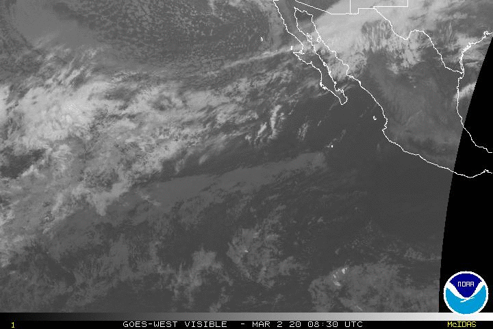
While not all that impressive on satellite imagery, TS Ivo remains on a great track and we still expect fun-size surf in SoCal later this weekend. Ivo appears to be slowly weakening now and expected to weaken further over the weekend. As we have mentioned in our last couple updates, the track to the NNW is about as good as it gets for SoCal swell production even though Ivo isn’t a strong or large tropical cyclone.
Gradually weakening as it tracks to the NNW and should weaken further this weekend, likely down to a remnant low Sunday afternoon or Monday.
Maximum sustained wind of 55 knots.
Watches/Warnings/Threats: None at this time.
Malibu's LaLanne Surf just put out this video of these two surfing Topanga.
"There are a hand full of surfers that know the feeling of the Gemini surfboard created by shaper Jeff Alexander in the mid 90's. Shaper and Malibu local Jon LaLanne started making the board 10 years ago in an effort to revive the design that Surfer magazine snubbed and never rode the board.Kelly Slater held the board for hours at the 2003 surfer poll awards. Tomo created his Vader off the Gemini and shapers like Stretch , Mickey Munoz, Dane Hantz from Vulcan and Scott Anderson were inspired by the design..." - LaLanne Surf
Dont miss Dogtown Rumble, the last one was 2 years ago! Once again Odd Squad Car Club is hosting their beach front car show taking place in the Venice Beach parking lot. Lots of cool cars and trucks show up at each show, and being at the beach, many are surf rides. IT's held in the Venice Blvd parking lot at Venice Beach.
If the cops decide to shut it down, it will turn into a Rebel Run up to Netptune's Net.
Tropical Storm Ivo continues to gradually strengthen and is currently expected to produce fun to possibly medium-size surf for Southern California and Northern Baja. The official forecast from the National Hurricane Center indicates that Ivo will strengthen to a hurricane later today just as it slows down and takes on a very favorable track for SoCal swell production.
Ivo is currently strengthening as it tracks to the west. The tropical cyclone is expected to slow considerably and take a NNW track late today and Friday as it peaks in intensity.
Strength: Maximum sustained wind of 55 knots.
Location/Movement: Roughly 550 miles SSW of Cabo tracking west (270 degrees) at 10 knots.
Watches/Warnings/Threats: None at this time.


Social Buttons