Latest News
Showing posts with label Featured Stories. Show all posts


Here are answers to questions we've been getting about the status of surfing at Sunset:

NOTE: This is solely to give answersto the numerous questions we have been receiving about surfing at Sunset. This is not encouragepeople to ho surf or to break any kaws, just answering questions with the knowledge we have observed.

Is Sunset open for surfing?
It was never really closed.

Is PCH open?
It is only open to those that have a proper pass. The closure/checkpoint is at Chautauqua/W Channel Rd. Only vehicles with passes are allowed to continue on PCH. So without a pass, you can not drive a vehicle up to Sunset.

Can I bike up PCH?
If you have the proper pass, it depends on who is at the checkpoint, some gaurds let you through, some say "No bikes...too dangerous".

As of Friday, 4/25, CHP was stationed near Sunset turning back people riding bikes and walking up PCH. stuff changes constantly.

How have people been surfing there, and at Topanga?
They have passes to be in the area, or they snuck in.

Is Will Rogers open?
Yes, the beach and the bike path are now open.

Can I get to Sunset from Will Rogers?
Yes, but the main Will Rogers parking lot is still closed. The small parking lot at Entrada is open, that lot is before the PCH closure. If you park there you can walk or bike up the path to the Bay Club then go around the Club to Sunset. There has been no beach closures, the beach is open all the way to Sunset.


How far is it from the parking lot (the small lot) to Sunset?
About 2.3 miles. A 10 minute bike ride at an easy pace.


I heard there's a secret route to go there and to Topanga?
First Rule and Second Rule

Can I park at Sunset?
The Gladstones lot is closed, it is being used by a constuction company. Vehicles have been parking along PCH.

Is Randy still there/Is he okay?
He is still there, he appears okay.

How's the water?
It appears the same as Santa Monica. There are mixed answers to this.

Is the bike path the only way to get to Sunset for those without a pass?
As of Friday, 4/25, it is possible to ride the bike path to the very end o the Will Rogers Parking where the Bay Club is, then walk the beach over to the rocks at Sunset. CHP was stationed near Sunset turning back people riding bikes and walking up PCH.

Is there police and National Gaurd all over PCH?
There is a heavy presence of both CHP and LAPD all along PCH. A lot of vehicles have been seen getting pulled over. The National Gaurd is stationed at specific areas.


The beach and the bike path at Rogers State Beach in Pacific Palisades finally reopens after being closed to the public for over 3 months due to the Palisades Fire. The video above was shot on Friday evening, showing that the National Guard is gone and there is no more closure of the beach or bike path. The beach and bike path are open all the way to the end where Sunset Point is.

Pacific Coast Highway Closure remains enforced and the large Will Rogers Beach Parking lot is still closed. The Will Rogers Lot 1 (small lot at the Santa Monica border) is open.


For surfers wanting to go surf Will Rogers or Sunset, as of Friday evening, it is possible to go there via the bike path (and then walk the beach past the club to Sunset).

For more news and updates on the Palisades Fire, Click Here.


Governor Gavin Newsom today announced an all-hands-on-deck effort to support businesses and tourism by expediting fire cleanup efforts so that State Route 1, the Pacific Coast Highway (PCH), will reopen to public travel by the end of May – well ahead of experts’ original predictions.

The Pacific Coast Highway is a major artery that serves hundreds of thousands of Angelenos and visitors from around the world daily and is crucial to connecting Los Angeles with Pacific Palisades, Malibu, and points north. Currently, PCH is only open to residents who live in the Palisades Fire burn area, essential businesses, and repair crews. Following the reopening, one lane in each direction would be available for public travel.

With the busy summer months along the coast fast approaching, the Governor’s Office of Emergency Services and Caltrans will effectuate the reopening by working closely with the United States Army Corps of Engineers (USACE) to prioritize the cleanup of parcels along PCH by surging additional crews into the area so that these parcels can be cleared of debris quickly.

Crews will work around the clock – literally 24/7 – to demolish the damaged and collapsed homes, remove toxic ash and soot, repair the roadways, and install new utility equipment.

There are currently more than 100 USACE crews (consisting of excavators, metal crushing equipment, and dump trucks) working on Palisades Fire parcels. All equipment and dump trucks utilize PCH as a path of travel for the haul routes. Currently, USACE is removing nearly 1,284 truckloads of debris per day.

Once their work is complete, PCH will be able to safely reopen to the public with one lane in each direction.

Once the highway is reopened, security checkpoints currently in place on the north and south ends of closure will be removed, but a robust law enforcement presence from state and local agencies will remain in place.

For more news and updates on the Palisades Fire, Click Here.


Public Health Releases Preliminary Soil Testing Results With Unanticipated Elevated Lead Levels in Parcels Downwind from Eaton Fire

The Los Angeles County Department of Public Health released preliminary findings from representative soil sample testing in and around the Eaton and Palisades fire areas, revealing a higher percentage of soil samples with lead levels above health-based screening thresholds from parcels with intact homes downwind of the Eaton Fire.

The preliminary findings also indicate localized chemical impacts to soil above health-based screening thresholds are present in the Palisades fire area, but there is no evidence of widespread contamination from fire-related chemicals.

The County’s soil sampling and analysis, conducted by Roux Inc., measured levels of harmful substances that may be present after a wildfire—such as heavy metals, polyaromatic hydrocarbons (PAHs), and dioxins—on representative soil samples from various parcels in different areas and with different property conditions in and around the Eaton and Palisades fire areas. Over four weeks from mid-February to mid-March, soil samples were collected from destroyed, damaged, and intact properties within the burn areas, as well as from properties just outside, and compared to current residential soil screening level thresholds. A final report and analysis will be available in May.

Levels below the screening thresholds are considered protective over a lifetime of exposure, even for the most vulnerable people. If levels exceed the screening thresholds, it does not automatically mean cleanup is required, but it suggests the need to consider additional evaluation.

Representative soil sampling involves collecting soil samples from different areas affected by the fire to assess contamination levels, such as ash or chemicals, and understand the overall impact on the environment.

The identification of high frequent lead exceedances in soil samples from downwind of the Eaton fire are consistent with reports of elevated lead in air samples collected in the days immediately following the fire. The source of lead in the fire is reasonably expected to be from the burning of homes with lead-based paint, which was common prior to 1979. CalTech reported that more than 90 percent of the houses in Altadena were built before 1975.

However, because there are many potential sources of lead in soil in the Los Angeles area, additional assessments will help understand how much of the lead found in the samples came from the 2025 wildfires versus other sources.

Testing identified isolated areas of heavy metal and PAH soil sample exceedances above screening thresholds in the Palisades fire area. The source is unknown at this time, but these are not consistent with communitywide impacts from fire-related smoke plumes.

This assessment provides a representative analysis of the soil in areas and under different conditions impacted by the fires. Individual parcels may have unique factors that result in differences compared to these representative samples. The reported results are not intended to imply cleanup or specific remediation is necessary; rather, the results identify areas potentially requiring additional evaluation.

Those with concerns about their specific property may want to test their soil and/or consult an environmental professional about evaluating their property. In all areas with on-going fire debris, residents are reminded to take precautions to not inhale, ingest or come into contact with ash, soot, and/or fire debris by using appropriate personal protective equipment. Additionally, community members are encouraged to review the soil sampling results and consider taking appropriate precautions if your home is in one of the areas where soil sample screening thresholds have been exceeded. Residents can refer to the Los Angeles County Department of Public Health’s FAQs for best practices to minimize exposure to these potential hazards.

In response to potential health risks from wildfire-related smoke, ash, and debris, the Los Angeles County Department of Public Health is offering free blood lead testing for individuals concerned about exposure to lead. Testing is available through three easy options: by visiting a medical provider (with costs covered by most insurance plans, including Medi-Cal), scheduling a free appointment at a Quest Lab by calling 1-800-LA-4-LEAD, or accessing walk-in mobile testing offered at select community events. Testing is fast, free, confidential, and does not require insurance. Lead exposure can be especially harmful to children and pregnant individuals, and early detection is key. For more information or to find testing locations, call 1-800-LA-4-LEAD (1-800-524-5323).

For larger versions of the following charts, Click Here


For more news and updates on the Palisades Fire, Click Here.


After almost 3 months, this video shows the current conditioins of the beach, creek, parking lot and general area around Topanga State Beach.

For more news and updates on the Palisades Fire, Click Here.


After almost 3 months, homes on the beach in Malibu are finally being fully cleared of all fire debris.

For more news and updates on the Palisades Fire, Click Here.


Touring the devastating damage from the Palisades Fire to all the homes on the hillside above the "Alphabet Streets" in the Pacific Palisades. These homes had beautiful views of the ocean, several are tagged as dangerous as they are in danger of falling onto the hilside.

For more news and updates on the Palisades Fire, Click Here.


PACIFIC PALISADES A home on Castellammare Drive that survived the Palisades Fire was completely destroyed when the hill behind it came sliding down crushing it and covering the street.

For more news and updates on the Palisades Fire, Click Here.


A updated tour of the current status of The Village (downtown area) of the Pacific Palisades.

For more news and updates on the Palisades Fire, Click Here.


Touring the Pacific Palisades "Alphabet Streets" during the fire recovery clean up.

For more news and updates on the Palisades Fire, Click Here.


Topanga Canyon Boulevard (SR-27) remains closed to the public for safety reasons between Pacific Coast Highway (PCH) and Grand View Drive due to the recent rain. Areas were washed out and now need structural repair and cleanup. This is in addition to repairs for fire-related damage. As Caltrans works to restore the road, it will maintain access for emergency responders and is exploring options for limited access, when safely feasible. There is no estimated time of reopening.

Another safety threat was the recent discovery of a large boulder, measuring 30 feet by 15 feet by 10 feet, which is in an unstable position above the roadway between postmile 2.1 and 1.7. Last week, Caltrans began a rock scaling operation after coordinating with utilities to shut off power due to its proximity to a powerline. The area was closed to all – including Caltrans Maintenance, contract crews and utility workers. On Monday, February 24, crews were able to successfully blast the boulder and resume clearing of SR 27.


Utility companies are continuing major repair work, including rerouting a main water line and underground electrical work, which will impact the shoulder and lane. This will require one-way traffic control for contractors. Prior to the recent rain, Caltrans geotechnical engineers identified more than 20 locations along SR 27 that need debris flow barriers and culvert replacement. Additional work and safety measures, such as scaling and installation of rockfall cable mesh, are needed to restore slope stability and roadway safety.

Although reopening the roadway is dependent on cleanup, repair work and weather, Caltrans stands ready to execute a reopening plan in coordination with the CHP, utilities, and any affected public agencies as soon as it is safe to do so. We recognize the critical role these corridors play in the clean-up and recovery efforts for the residents and the public. The decision to reopen lanes must be a joint decision from all parties with a specific plan in place and with safety as the top consideration. We will keep you informed of potential plans to provide limited, escorted access during designated periods.

For more news, updates and traffic conditions on PCH and other local beachside roads, Click Here.

For more news and updates on the Palisades Fire, Click Here.


Touring the businesses that where destroyed by the fire in Pacific Palisades as they enter "Phase 2" of the clean up.

For more news and updates on the Palisades Fire, Click Here.


Despite the city's health warnings about ash, chemicals, and debris from the Palisades Fire contaminating the ocean water, several surfers have been out catching waves.

For more news and updates on the Palisades Fire, Click Here.


The EPA will using the Parking lot at Will Rogers State Beach in Pacific Palisades as a hazardous waste processing site. Concerned citizens took action, organizing a protest on Sunday, February 9, 2025 to demand that the site be relocated to a safer, more controlled environment.

For more news and updates on the Palisades Fire, Click Here.


Touring the damage to Topanga Beach from the Palisades Fire.

For more news and updates on the Palisades Fire, Click Here.


The Eviromental Protection Agency is now going to turn Will Rogers Beach into a Toxic Waste Site.

Here is the EPA's staement:

The U.S. Environmental Protection Agency (EPA) is working with the California Governor’s Office of Emergency Services (Cal OES), the California Environmental Protection Agency (CalEPA), the California Department of Toxic Substances Control, California State Parks, and the city and county of Los Angeles to assist in the safe removal of household hazardous materials from properties damaged by the Palisades Fire. This necessary action helps speed up debris removal on properties destroyed by the wildfire and will enable residents to rebuild their homes faster.

The parking lot at Will Rogers State Beach will serve as a temporary site for household hazardous materials collected and transported from nearby properties to be consolidated, securely packaged, and safely loaded for transportation to a permanent disposal or recycling facility outside of the area. This location is suitable because it is flat, open land close to damaged properties that require debris removal.

The Will Rogers State Beach parking lot is a California State Parks property that has been operated by Los Angeles County for more than 50 years through an agreement with State Parks. Los Angeles County has a separate agreement with the City of Los Angeles for the maintenance of the parking lot. All agencies are working closely to complete this critical recovery work safely and efficiently.

The temporary processing site is closed to the public, and EPA is using best management practices to process any hazardous household material and keep it contained within the facility. Throughout this process, EPA will conduct air monitoring to ensure that operations in and around the site are health protective.

This site is an important part of Los Angeles’ ongoing efforts to safely remove fire debris so that the recovery and rebuilding process can move forward as quickly and safely as possible. We ask for your patience and understanding as state and federal partners work towards recovery for our community.

For more news and updates on the Palisades Fire, Click Here.


Touring the fire destruction along the coast and current condition of Pacific Coast Highway in Malibu. This is going from the northern end of the burn area to Topanga Beach, viewing the coast side of PCH.

Upcoming videos will focus on the east side of PCH and then Topanga Beach and further south.

For more news and updates on the Palisades Fire, Click Here.


The City of Malibu has released a statement about the EPA using the area where the Topangas Ranch Motel was as a Toxic Waste Station. This contradicts what a few of the local politcians have been saying about it. It will be a toxic waste sorting and packing site. NOT a just a "storage and staging" site.

Here is the City of Malibu's updated statement:

Update with factual information addressing concerns about US EPA's Palisades Fire hazardous materials temporary staging area at Topanga & PCH and assurances by EPA about measures to ensure the safety of the environment & the community.

1/31/2025 - UPDATE FROM CITY OF MALIBU ADDRESSING CONCERNS ABOUT THE EPA'S PALISADES FIRE HAZARDOUS MATERIALS TEMPORARY STAGING AREA AT TOPANGA AND PCH

The City is aware of community concerns we’ve heard about the U.S. Environmental Protection Agency (EPA)’s fire cleanup efforts and the use of the former Topanga Motel site on Pacific Coast Highway as a staging area. We know that this is an emotional time for our community, and want to provide clear, factual information about what is happening and what this means for Malibu.

The EPA is currently conducting Phase 1, hazardous materials cleanup following the Palisades Fire. This is an important first step in helping residents return home safely and quickly while protecting the environment, including our streams and oceans. During this Phase 1, EPA teams are going into the burn footprint and carefully removing hazardous household waste — things like propane tanks, paints, batteries, and household chemicals that need to be properly handled. The Topanga site is only for the first Phase materials — burn debris removal in Phase 2 will bypass this site entirely and go straight to disposal.

Because of the size of the impacted area, the White House has directed the EPA to complete this work in 30 days — something that would normally take six months to a year. To make that possible, the EPA has deployed over 1,000 personnel and 60 teams to get the job done quickly and safely.

The Topanga site is a staging site, not a disposal or storage site. Teams are temporarily bringing collected materials to the Topanga site, sorting and repacking them safely, and then promptly transporting them out of the area for final disposal. All of this activity is following strict federal guidelines.

This Topanga property is outside the Malibu City limits and is owned by California State Parks and has been authorized for use by the State. That decision was made without consultation with Malibu or advance notice. We understand this site was chosen because it is within the burn area and has the space needed to safely manage operations.

We understand the concerns about the potential for environmental contamination, we want to assure the community that the EPA has reaffirmed that it has strict safety measures in place.

The EPA has confirmed to the City of Malibu that:

1. The area is highly secured, fenced off, and only accessible to EPA personnel.

2. The staging area is lined with plastic, with spill control measures in place, including wattles, berms, and booms — to prevent anything from leaving the site.

3. Continuous air monitoring is happening around the perimeter, and a water truck will suppress dust multiple times a day to reduce visible emissions.

4. The EPA pre-tested the soil before use and will test it again after they leave to ensure there is no contamination left behind.

Additionally, the City has made it clear that no additional staging or sorting sites will be located within Malibu city limits.

The City is providing a muster site near City Hall, but this is only for EPA staff to meet, receive briefings, and conclude their day — no materials or equipment will be stored there.

We understand this is a challenging time, and we appreciate your patience as this process unfolds. The City will continue to advocate for Malibu’s residents, ensure transparency, and share accurate information. First and foremost, we are focused on protecting our environment from the household hazardous and burn materials that are the result of the Palisades Fire, and their environmentally safe removal and transport.

The City encourages you members to stay informed and engaged — we will continue to update the community as we learn more. Thank you.

For more news and updates on the Palisades Fire, Click Here.


The Los Angeles County Department of Public Health cautions residents who are planning to visit the below Los Angeles County beaches to avoid swimming, surfing, and playing in ocean waters:

January 30, 2025

Ocean Water Closure and Advisory in Fire Impacted Areas Remain - All Other LA County Ocean Waters Advisories Lifted 01/30/2025

Due to the increase in fire debris along these ocean waters, the Ocean Water Closure for Las Flores State Beach to Santa Monica State Beach remains in place, as fire debris runoff and pollutants in the water may contain toxic or carcinogenic chemicals. Beach users should avoid water and stay away from fire debris or heavy ash on the sand.

Exact locations of the closure can be viewed on the interactive map below.

The ocean water advisory for Surfrider Beach to Las Flores State Beach and Santa Monica State Beach to Dockweiler State Beach at World Way remains in effect due to fire debris runoff, which may also flow onto or pond on the beach sand. Beach users are also advised to stay away from any fire debris on the beach.

The closure and advisory due to fire related impacts will remain in effect until further notice.

The rain advisory for all other LA County ocean waters has been lifted.

Maintenance crews from the Department of Beaches and Harbors are removing and disposing of the large pieces of charred debris that wash up onto the sand. Additionally, DBH is working with its partners to address ongoing concerns about fire-related runoff from winter storms.

Use the map below to obtain the current water quality status of your favorite beach location. Use your mouse wheel to zoom into a particular location. Click on the marker to identify the sampling location. This map is updated as conditions change.


For more news and updates on the Palisades Fire, Click Here.


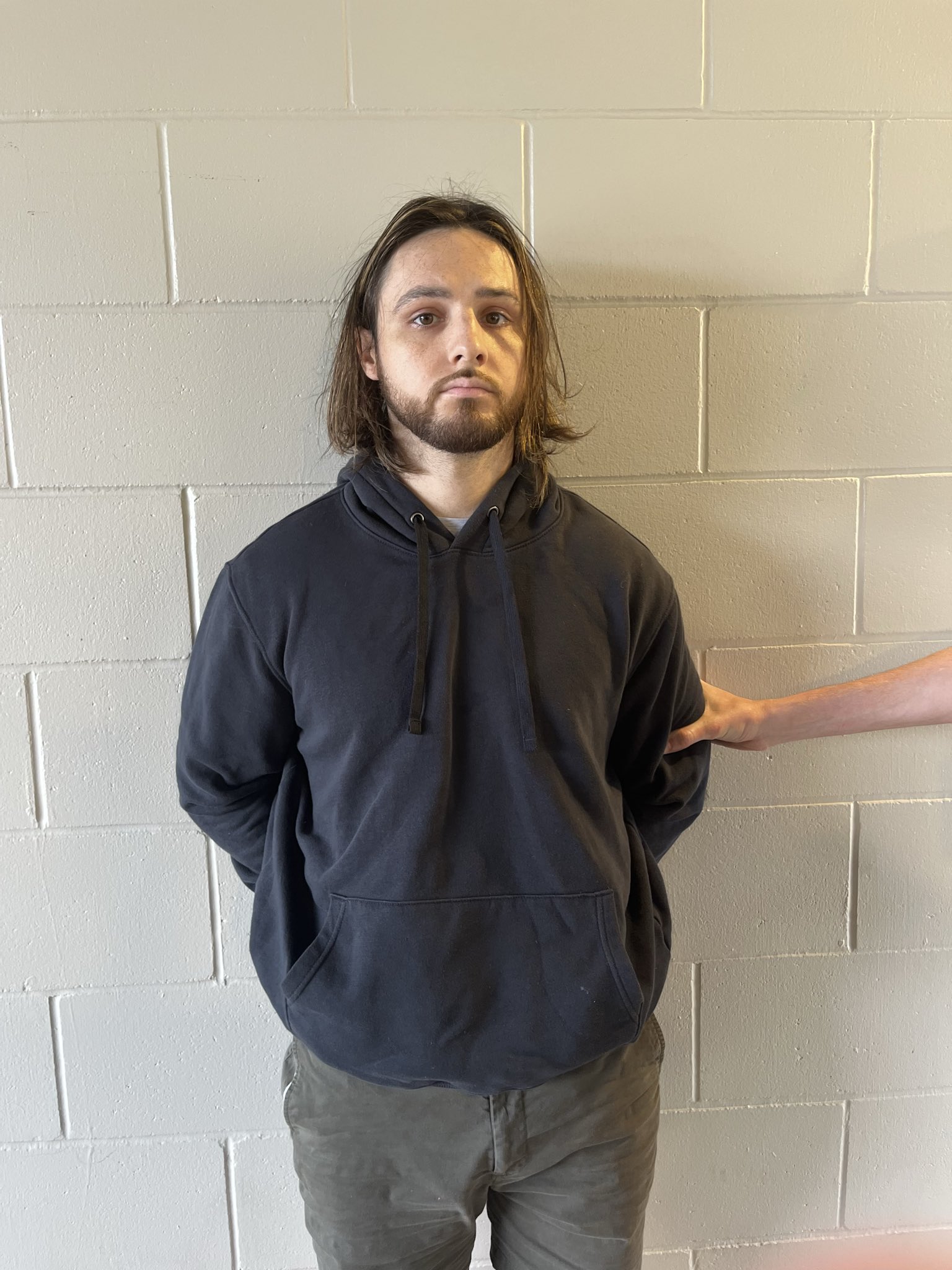
Convicted arsonist Dustin Nehl and his wife were arrested for impersonating firefighters with a fake truck in the Pacific Palisades.


Two Individuals from Oregon Arrested for Impersonating Firefighters within Palisades Fire.

The LA County Sheriff's Department released this Statement:

"On Saturday, January 18, 2025, Los Angeles County Sheriff’s Major Crimes Bureau investigators were contacted regarding an arrest of two suspects for impersonation of firefighters. An LAPD patrol unit was driving through the Palisades Fire area with fire personnel and observed a fire truck that did not appear to be legitimate. They relayed the information, and Sheriff’s deputies contacted the individuals in the fire truck as they attempted to enter an evacuation zone.

Upon contacting the two occupants of the truck, deputies noticed they were both wearing turnout gear. The occupants claimed to be from “Roaring River Fire Department” in Oregon. Upon further investigation, the deputies learned that the department name was not a legitimate agency, and the truck was purchased at an auction. The two occupants were wearing CAL-Fire t-shirts under the turnout gear, helmet, and radios.


The two admitted to being in the evacuation zone on Friday, January 17, 2025. Deputies arrested Dustin Nehl, 31, and Jennifer Nehl, 44, for Impersonating a Firefighter and Entering an evacuation zone, and the truck was impounded.

Suspect Dustin Nehl has a criminal history in Oregon for criminal mischief and arson. Neither have a criminal history in California."


Nehl admitted to committing several acts of vandalism between 2013 and 2016, including causing an explosion on a property on Cascade Drive, damaging locks and a water tank at the City of Woodburn Water Treatment Facility in Centennial Park and damaging other property in an amount exceeding $2,000. He also admitted to possessing an "incendiary device."

Nehl pleaded guilty to one count of second-degree arson, one count of attempt to commit a class A felony, one count of unlawful possession of a destructive device, and three counts of first-degree criminal mischief. The crimes are all felonies. The charges stemmed from Nehl committing multiple acts of vandalism at Woodburn Estates & Golf properties and at a city of Woodburn property between 2013 and 2016.

Investigators will be presenting the case to the Los Angeles County District Attorney’s Office for filing consideration on Tuesday.


Anyone with information about this case is encouraged to contact the Major Crimes Bureau at 562-946-7893.

For more news and updates on the Palisades Fire, Click Here.