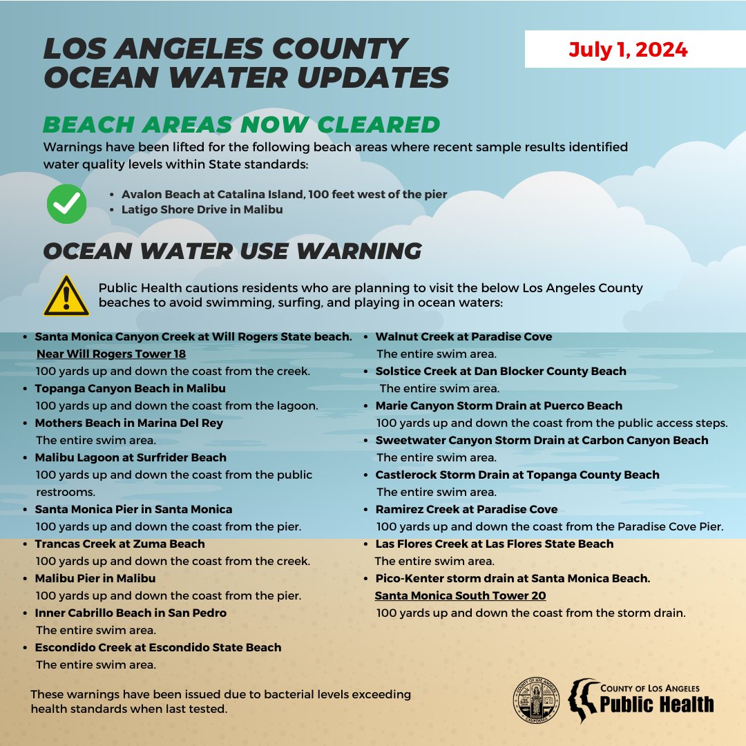
 July 01, 2024
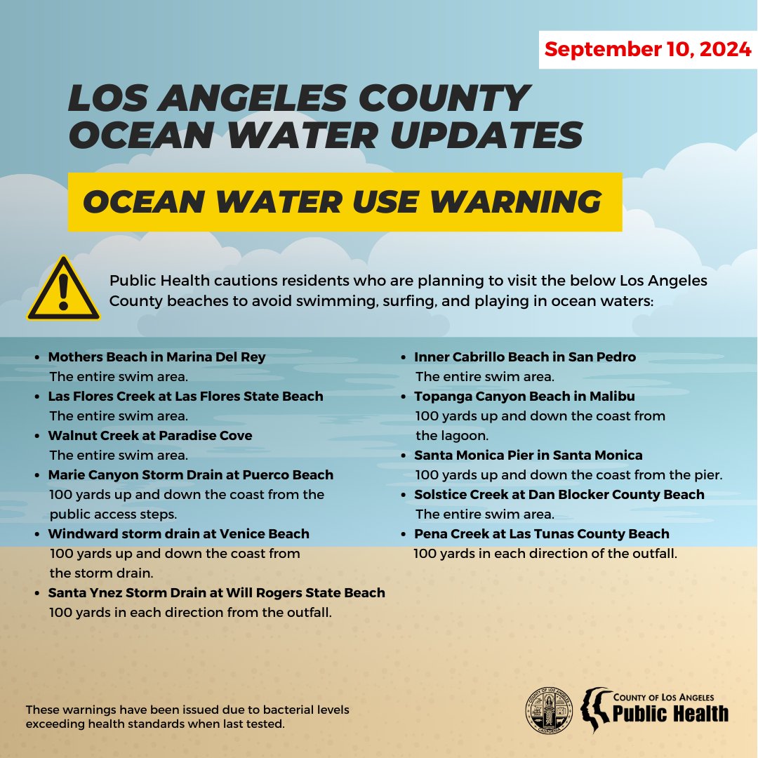
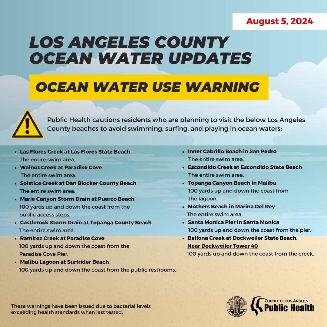
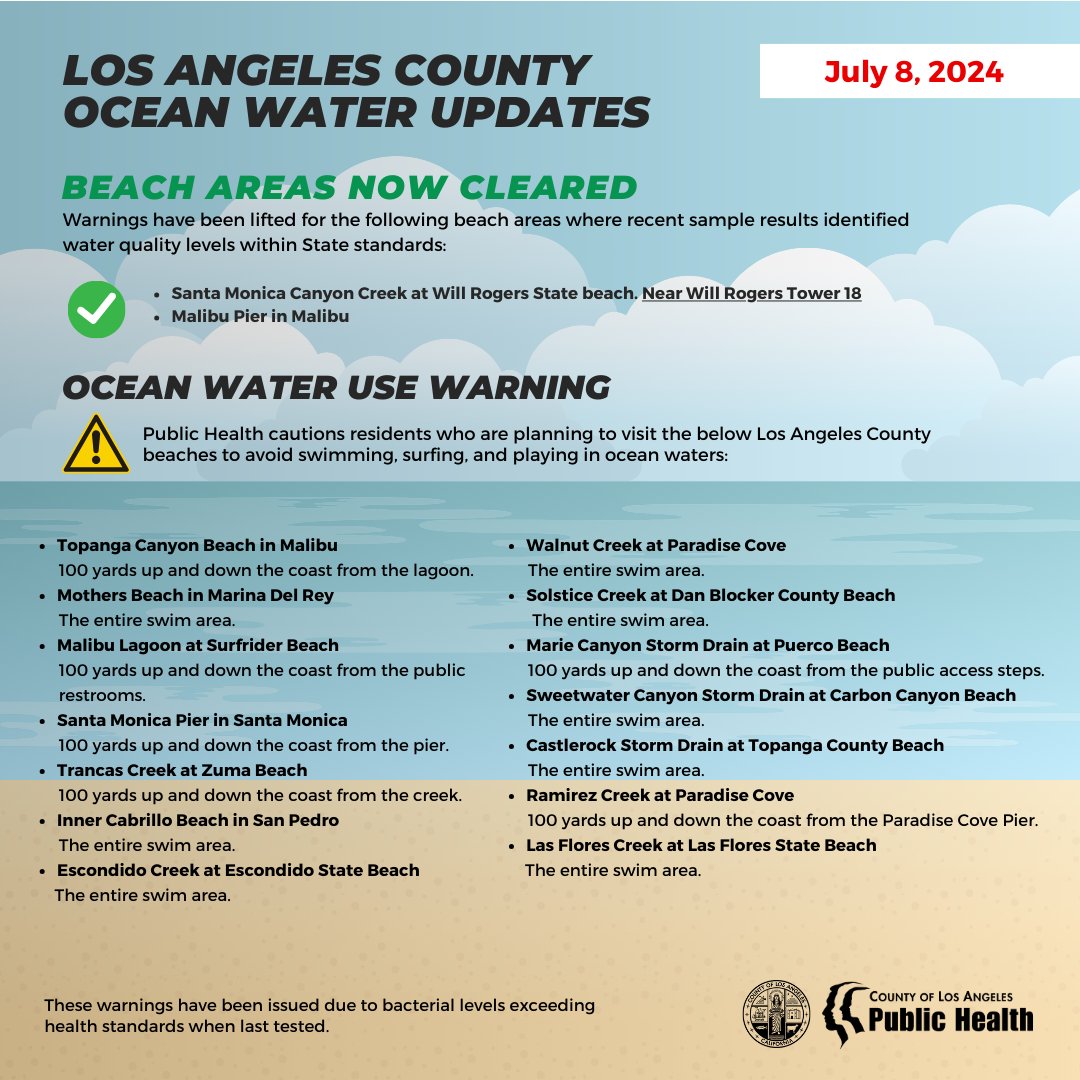
The Los Angeles County Department of Public Health cautions residents who are planning to visit the below Los Angeles County beaches to avoid swimming, surfing, and playing in ocean waters:
BEACH AREA WARNINGS:
· Las Flores Creek at Las Flores State Beach
The entire swim area.
· Santa Monica Canyon Creek at Will Rogers State beach. Near Will Rogers Tower 18
100 yards up and down the coast from the creek.
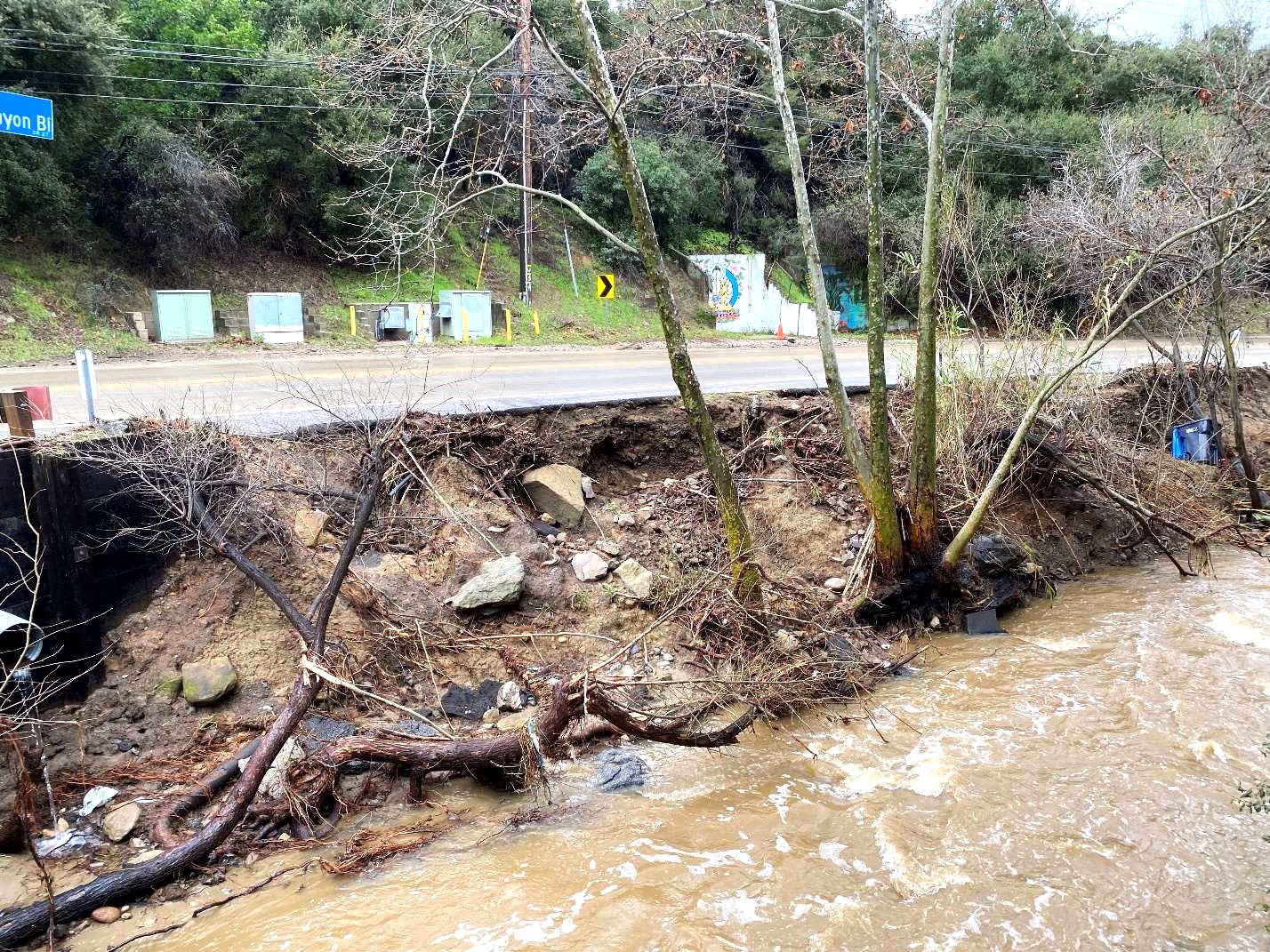
· Topanga Canyon Beach in Malibu
100 yards up and down the coast from the lagoon.
· Mothers Beach in Marina Del Rey
The entire swim area.
· Malibu Lagoon at Surfrider Beach
100 yards up and down the coast from the public restrooms.
· Santa Monica Pier in Santa Monica
100 yards up and down the coast from the pier.
· Trancas Creek at Zuma Beach
100 yards up and down the coast from the creek.
· Malibu Pier in Malibu
100 yards up and down the coast from the pier.
· Inner Cabrillo Beach in San Pedro
The entire swim area.
· Escondido Creek at Escondido State Beach
The entire swim area.
· Walnut Creek at Paradise Cove
The entire swim area.
· Solstice Creek at Dan Blocker County Beach
The entire swim area.
· Marie Canyon Storm Drain at Puerco Beach
100 yards up and down the coast from the public access steps.
· Sweetwater Canyon Storm Drain at Carbon Canyon Beach
The entire swim area.
· Castlerock Storm Drain at Topanga County Beach
The entire swim area.
· Ramirez Creek at Paradise Cove
100 yards up and down the coast from the Paradise Cove Pier
· Pico-Kenter storm drain at Santa Monica Beach. Santa Monica South Tower 20
100 yards up and down the coast from the storm drain
These warnings have been issued due to bacterial levels exceeding health standards when last tested.
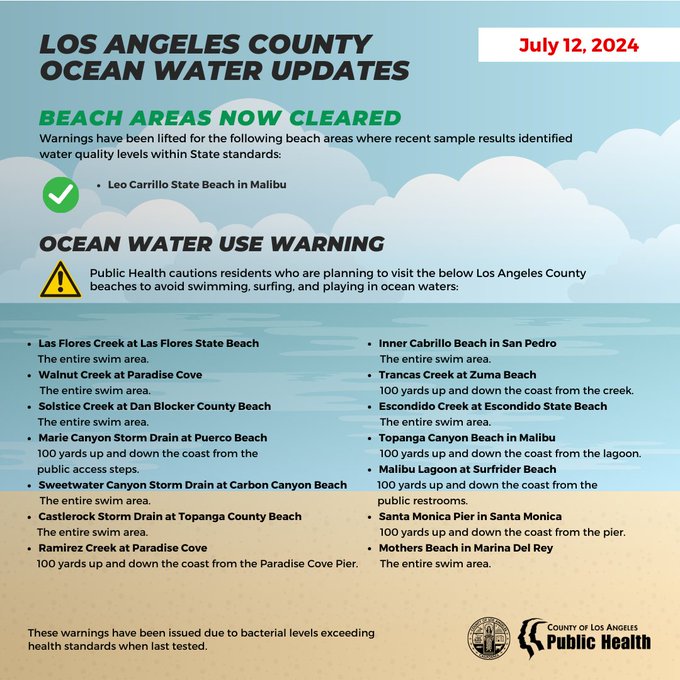
BEACH AREAS NOW CLEARED:
Warnings have been lifted for the following beach areas where recent sample results identified water quality levels within State standards:
· Avalon Beach at Catalina Island, 100 feet west of the pier
· Latigo Shore Drive in Malibu
Use the map below to obtain the current water quality status of your favorite beach location. Use your mouse wheel to zoom into a particular location. Click on the marker to identify the sampling location. This map is updated as conditions change.


Social Buttons