Latest News
Showing posts with label Malibu. Show all posts


POWERFUL & DAMAGING SANTA ANA WINDSTORM INCOMING!!


Damaging Santa Ana Winds and extreme fire weather are expected the the Santa Ana wind prone corridors of Los Angeles and Ventura Counties. Fire weather concerns last from Monday through Tuesday with winds peaking Monday afternoon through Tuesday morning.


The wind forecast is similar to Jan. 7, the night the Palisades and Eaton fires broke out, but the air mass will be even drier. Relative humidity is forecast to range from 3% to 15%. Some weather models indicate the amount of atmospheric moisture, known as precipitable water, will be at all-time record minimums across Southern California.

For more news and updates on the Palisades Fire, Click Here.


Avoid Water Contact from Surfrider Beach to Dockweiler Beach at World Way

January 17, 2025

The Los Angeles County Department of Public Health is extending the duration of the Ocean Water Advisory due to fire debris runoff. Ash from the Los Angeles Fires may enter coastal water through surface water runoff and windblown ash. The ash may contain substances including arsenic, other metals, and asbestos, which can be harmful to human health. The Department advises beach users to avoid all water contact from Surfrider Beach to Dockweiler State Beach at World Way.

This advisory will remain in place until lifted by the Department of Public Health.

Recorded information on beach conditions is available 24-hours a day on the County's beach closure hotline: 1-800- 525-5662.

Use the map below to obtain the current water quality status of your favorite beach location. Use your mouse wheel to zoom into a particular location. Click on the marker to identify the sampling location. This map is updated as conditions change.

For more news and updates on the Palisades Fire, Click Here.


Heads up! Strong, locally damaging, NE/E winds will affect West LA Co. & much of Ventura Co thru Wednesday. Critical fire weather is expected, so PLEASE have multiple ways of getting notifications in case of new fires & prepare ahead of time. "

For more news and updates on the Palisades Fire, Click Here.


"Help Rebuild Cholada Thai in Malibu: A Community Legacy Lost in the Palisades Fire

Hello, my name is Nick, and I’m the owner of Cholada Thai in Malibu.

For 25 years, Cholada Thai has been more than just a restaurant to me – it has been my life. I have spent nearly every single day at the restaurant, pouring my heart into every dish, every interaction, and every moment spent with our amazing customers. Cholada isn’t just a business; it’s a place where I’ve built lifelong relationships, served countless families, and worked side by side with an incredible team.

Unfortunately, as many of you know, Cholada Thai was destroyed in the devastating Palisades Fire. This loss isn’t just a physical structure – it’s a piece of my heart, and it’s the loss of a special place that meant so much to the Malibu community.

Why I Need Your Help

I am reaching out to you, my community, with a heavy heart but also a great sense of hope. Rebuilding Cholada Thai will take time, resources, and support – and that’s where you come in. I want to bring back the restaurant that has been a part of Malibu for so long, but I can’t do it alone.

The funds raised will go directly toward Cholada Thai so we can rebuild the restaurant to the high standards of quality and warmth that you’ve all come to know and love. It’s not just about restoring a business – it’s about giving back to the community that has supported us for all these years.

How You Can Help

Donate: Any amount will make a difference. Whether it’s $5 or $500, every contribution will help us rebuild.

Share: Spread the word. Even if you’re not able to donate, sharing this campaign with your network will help us reach more people who can help.

Come Back: When Cholada is back up and running, I can’t wait to welcome you all through the doors again.

Cholada Thai has always been a place of warmth, laughter, and community. Together, we can rebuild it stronger than ever. I deeply appreciate every bit of support, whether financial or emotional, as we work to get Cholada back on its feet.

Thank you from the bottom of my heart.

With gratitude,
Nick
Owner, Cholada Thai Malibu"


For more news and updates on the Palisades Fire, Click Here.


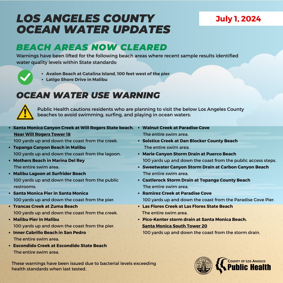
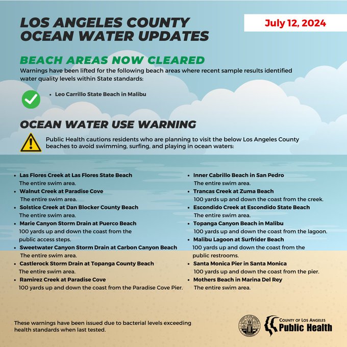
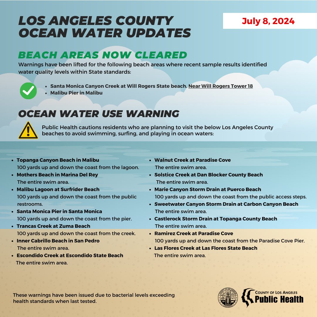
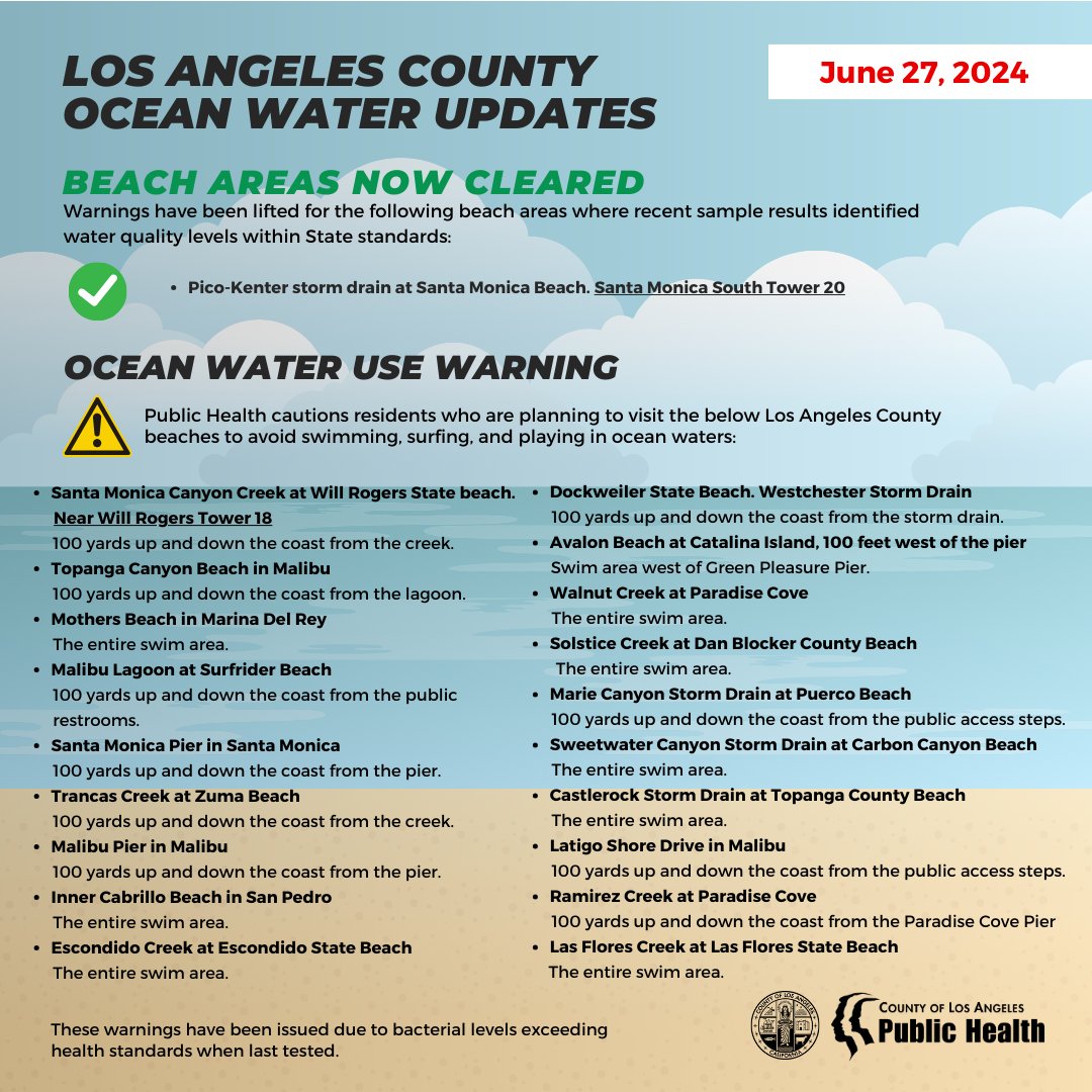
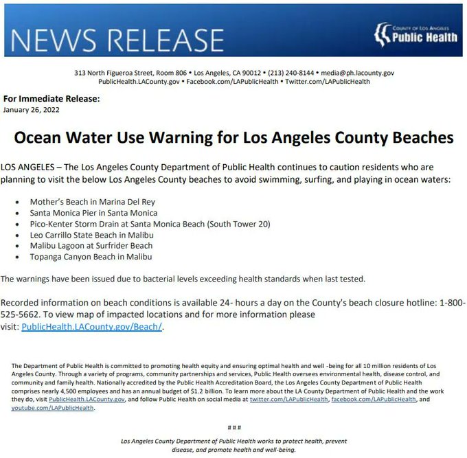
The Los Angeles County Department of Public Health cautions residents who are planning to visit the below Los Angeles County beaches to avoid swimming, surfing, and playing in ocean waters:

January 10, 2025

The Los Angeles County Department of Public Health urges residents to avoid swimming, surfing, and playing in ocean waters at the following Los Angeles County beaches.

The Department advises beach users to avoid all water contact, especially near discharging storm drains, creeks, and rivers, due to potential debris and contamination from fires. This includes any runoff that may flow onto or pond on the beach sand. An ocean water advisory is being issued because of the uncertain amount of fire-fighting runoff, which may contain toxic chemicals and debris that have entered the ocean during fire-fighting operations.

This advisory applies to ocean and bay waters from Surfrider Beach to Dockweiler State Beach at World Way. People entering these waters could become ill. The advisory will remain in effect until three days after fire-fighting efforts end and notification is provided by the Department of Public Health.

Additional Specific Beach Area Warnings:

· Malibu Point at Surfrider Beach. Near Malibu Tower 3: 100 yards up and down the coast from Lifeguard Tower #3.

· Solstice Creek at Dan Blocker County Beach: 100 yards up and down the coast from the creek.

· Inner Cabrillo Beach in San Pedro: The entire swim area.

These warnings have been issued due to bacterial levels exceeding health standards when last tested.

Use the map below to obtain the current water quality status of your favorite beach location. Use your mouse wheel to zoom into a particular location. Click on the marker to identify the sampling location. This map is updated as conditions change.


For more news and updates on the Palisades Fire, Click Here.


The Palisades Fire jumped over PCH and several beach structures got fire at Will Rogers Beach.

For more news and updates on the Palisades Fire, Click Here.


Today, January 9, 2025, at approximately 1:00 p.m., SuperScooper Quebec 1 was struck by a civilian drone illegally flying in the Palisades fire area.


Quebec 1 sustained wing damage and remains grounded and out of service. There were no reported injuries. The incident is under investigation by the Federal Aviation Administration.

The LACoFD would like to remind everyone that flying a drone in the midst of firefighting efforts is a federal crime and punishable by up to 12 months in prison or a fine of up to $75,000.

For more news and updates on the Palisades Fire, Click Here.


Topanga Canyon Blvd/Route 27 will be CLOSED between Mulholland Drive and Pacific Coast Highway/Route 1 in Topanga area from 10 AM Tueday to 6 PM Friday, Jan. 7-10, due to Red Flag Warning fire danger. Only residents & local business traffic allowed in the canyon.

For more news, updates and traffic conditions on PCH and other local beachside roads, Click Here.


Life-threatening, hurricane-strength winds 50-80 mph expected in Malibu Tues 1/7, Wed 1/8. Stay indoors, away from windows. Stay off the roads.

Life-threatening, hurricane-strength winds expected in Malibu Tues 1/7, Wed 1/8. 50-80mph, up to 100mph winds can bring down trees & power poles, damage structures, knock over vehicles. Stay indoors, off roads, park away from trees. High fire danger.

Life-threatening, hurricane-strength winds expected in Malibu Tues 1/7 & Wed 1/8, 50 - 80 mph, gusts up to 100 mph. Winds can bring down trees, power lines and poles, damage structures, and knock over vehicles.

Wind will be strongest 10AM Tues – 4PM Wed. The National Weather Service considers this an unprecedented, historic, hurricane-strength wind event, and advises the public to stay indoors, in the first floors of structures, away from windows and trees, and off the roads. Bring outdoor furniture indoors. Park vehicles away from trees. Adjust travel plans.

Red Flag Warning, extremely dangerous fire conditions expected in Malibu 1/7 – 1/9. Be prepared for fires, evacuations, power outages, hazardous roads, and rough coastal waters.

Potential SCE power shutoffs in all of Malibu Tues-Wed. Monitor AM/FM radio news for emergency information using handheld or car radios, which will work when the power is out.

Seniors, people with disabilities, or those who are dependent on wheelchairs, oxygen or medical devices, should consider leaving the area early.

Be prepared for potential fires, evacuations, power outages, and hazardous roads, beaches and ocean waters. The City is closely monitoring conditions, coordinating with LA County Fire and Sheriff’s Departments, and will post emergency information as needed via alerts, the website, and social media as needed, and is ready to activate the Emergency Operations Center.

Come to a complete stop at any malfunctioning traffic signal.

Be extremely cautious with any potential source of fire ignition, such as using landscaping equipment. Any fire start could result in rapid fire growth and extreme fire behavior.

Topanga Canyon will be closed Tues - Fri, with access for residents and local businesses only.

Closely monitor weather conditions and emergency information on local news, especially AM / FM radio and 99.1 FM KBUU with handheld and car radios, which will work when the power is out.


, Widespread Windstorm is expected Tue afternoon-Weds morning across much of Ventura/LA Co. Areas not typically windy will be impacted. See graphic for areas of greatest concern. The wind direction of this event is more from the N-NE rather than typical NE-E Santa Ana's. This means the strongest wind corridors shift more east & focus over more of LA Co. than is typical (including San Gabriel foothills) rather than the Ventura Coast.


The strongest wind areas of LA and Ventura Counties will see widespread N-NE wind gusts of 50-80 mph, with isolated gusts up to 80-100 mph in the mountains and foothills. This could be the strongest event since Nov 30th/Dec 2011.

For more news and updates on the Palisades Fire, Click Here.


On Sunday, a Sheriff motor deputy was monitoring traffic on Pacific Coast Highway near Decker when a blue Lexus sped past him at 126 mph. The 19 yr old driver was arrested for Reckless Driving & the car was impounded for 30 days. This happened in the middle of the day.


For more news, updates and traffic conditions on PCH and other local beachside roads, Click Here.


Funding will help LA County protect 45 miles of coastline from sea level rise to ensure access for everyone.


Los Angeles County will receive $1 million from the California Ocean Protection Council (OPC) to advance coastal resilience efforts to protect the County’s iconic beaches from climate change-accelerated erosion threats, the Department of Beaches and Harbors (DBH) announced today.

The OPC governing board voted unanimously on Dec. 10 to provide the much-needed grant of state funds to preserve the County’s public beaches. The money from the OPC’s Sea Level Rise Adaptation Planning Grant Program, which aims to equip California’s coastal communities with the tools needed to combat climate threats, will support the development of the County’s Regional Coastal Strategic Adaptation Plan (RCSAP). The plan is a collaborative effort to protect 16 County-operated beaches, as well as State and local resources, along 45 miles of world-renowned coastline from threats posed by sea level rise and climate change.

“This grant allows us to build on our existing Coastal Resilience Initiative and take a significant step toward ensuring that LA County’s beaches remain resilient, accessible and sustainable for future generations,” DBH Director Gary Jones said. “We’re proud to collaborate with community stakeholders and experts in the field of coastal resilience to find solutions that address climate impacts while promoting equity, inclusivity and sustainability.”

Erosion that robs beaches of sand occurs naturally, but its effects are accelerated by dynamic weather patterns spurred by climate change. In LA County and other parts of the State, the resulting powerful storms and heavy wave action have reduced the size of some beaches and increasingly threatened public beach access and amenities and other essential coastal infrastructure.

In LA County, Zuma Beach loses approximately 3.6 feet of shoreline annually, Dockweiler erodes at a rate of 4.5 feet per year, and Redondo Beach faces narrowing challenges exacerbated by infrastructure disruptions. These findings underscore the urgent need for proactive coastal resilience measures.

“This funding secured from the state represents a major step forward in protecting and preserving our coastline for generations to come,” said Third District Supervisor Lindsey P. Horvath. “With this vital partnership, we will advance the County’s RCSAP, including design and robust community engagement for living shoreline projects across LA County. These efforts will protect our beaches and address the growing threats of climate change.”

The RCSAP is part of DBH’s Coastal Resilience Initiative, which aims to tackle these pressing challenges systematically by leveraging local, State and Federal resources and deploying nature-based strategies, while fostering collaboration with partners and stakeholders to ensure a sustainable coast that adapts to serve current and future generations.

“This project exemplifies how targeted investments can have far-reaching impacts, from protecting vital ecosystems to ensuring safe, inclusive access to all residents,” said Second District Supervisor Holly J. Mitchell. “It’s a win for our environment, economy, and communities.”

Building on the foundational work of DBH’s 2023 Coastal Resilience Study, the RCSAP will integrate cutting-edge solutions, including living shorelines, sediment reuse and enhanced shoreline management strategies.

“Tropical Storm Hilary last year and the extreme rains this year drove home that there is no time to bury our heads in the sand about the impacts of climate change across LA County,” said Fourth District Supervisor Janice Hahn. “It’s up to us to take action against the threat of coastal erosion. This grant is going to help us protect our beloved beaches for years to come.”

The RCSAP will engage a broad coalition of stakeholders, including municipal partners, tribal organizations, community advocates and regional agencies. These partnerships will help design and implement strategies tailored to the unique challenges and opportunities of LA County’s diverse coastal communities.

Highlights of the RCSAP include:


Community and Equity Focus: The project prioritizes equitable beach access for all, with a major focus on preserving coastal access for members of underserved inland communities disproportionately affected by extreme heat and limited recreational opportunities. The planning process will incorporate robust stakeholder engagement to ensure that diverse community voices shape the strategies for a sustainable coastline.

Holistic Approach: The RCSAP will go beyond piecemeal solutions and consider how projects will benefit beaches in the Santa Monica Bay as a whole. This holistic approach, combined with the plan’s focus on long-term sustainability, will ensure that the County’s beaches remain accessible, resilient and vibrant for years to come.

A Collaborative Future for California’s Coastline: The RCSAP is part of a larger statewide effort to build resilience against sea level rise, supported by the OPC’s Sea Level Rise Adaptation Planning Grant Program. By leveraging state funds and aligning with California’s sea level rise adaptation goals, DBH continues to set the standard for regional collaboration and innovative coastal management.

The RCSAP will be implemented over two years, with an initial on stakeholder engagement and data collection. Subsequent phases will develop actionable strategies and implementation pathways to build long-term resilience. To ensure transparency and accountability, key updates will be shared with the public and stakeholders throughout the project.


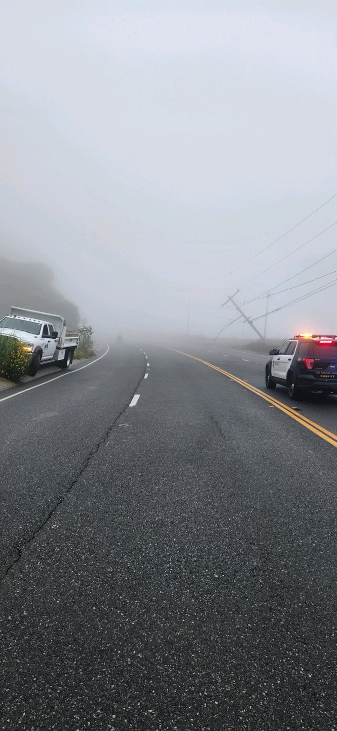
Overnight lane closures scheduled for northbound & southbound State Route 1 (PCH) from Corral Canyon Rd to Puerco Canyon Rd for drainage work & lane realignment the nights of Monday 12/23, Thursday 12/26 & Friday 12/27.

For more news, updates and traffic conditions on PCH and other local beachside roads, Click Here.


UPDATE: 12/18. 4037 acres burned, 89% containment. 100% of inspections are complete. Red Flag warning, extremely dangerous fire weather & PSPS power shutoffs continues until 6PM tonight (wind). City Hall is open, with a Franklin Fire Recovery Desk in the lobby

For more on the Franklin Fire, Click Here.


Red Flag Warning in Effect in Malibu Tues 12/17 to Wed 12/18/24

Santa Ana winds will increase across much of Los Angeles and Ventura Counties Tuesday afternoon with winds likely peaking Tuesday night through Wednesday morning. Northeast winds will rapidly develop with gusts likely ranging from 40 to 60 mph, strongest in the mountains. These winds combined with minimum humidity in the 10 to 20 percent range will very likely lead to critical Red Flag fire weather conditions developing Tuesday afternoon to evening and continuing through Wednesday afternoon.

For more on the Franklin Fire, Click Here.


Topanga Canyon Blvd/Route 27 is CLOSED between Mulholland Drive and Pacific Coast Highway/Route 1 in Topanga area from 3pm Tuesday 12/17 until 6pm Wednesday 12/18 due to Red Flag Warning fire danger.

Only residents & local business traffic allowed in the canyon.

For more news, updates and traffic conditions on PCH and other local beachside roads, Click Here.


Franklin Fire morning Update 12/15/24 9am - acreage remains at 4,037, and containment is now at 42%. Teams have completed 95% of the damage inspections, and the numbers remain at 19 structures destroyed (8 single family dwellings and 11 outbuildings), and 27 structures damaged (14 single family dwellings, 1 multi family dwelling, 7 commercial, and 5 outbuildings).

For more on the Franklin Fire, Click Here.


12/13/24 2:15 PM Update: Evacuation Orders Lifted and Road Access Fully Restored. Certain roads are only accessible to residents with photo ID.

12/13/24 2:15 PM Update: Evacuation Orders have now been reduced to Warnings, and all residents may return to their homes. Certain roads are only accessible to residents with photo ID.

12/13/24 2:15 PM Update:
The City of Malibu is pleased to announce that all Evacuation Orders have now been reduced to Warnings, and all residents may return to their homes. This significant milestone reflects the progress made by our first responders and partner agencies in ensuring the safety of our community.

Evacuation Zone Updates


Evacuation Warnings Lifted:

Zones MAL-C113-A, MAL-C113-C, VST-U022-A, MCR-U021-B, MTN-U028, SDP-U029-B, MAL-C112-F (which now includes the previously listed "G" zone), and MAL-C111-C.

All Remaining Evacuation Orders Reduced to Warnings:

Zones MAL-C113-D, VST-U022-B, MCR-U021A-B, SDP-U029-A, RMB-U030, and MAL-C112-B.

Evacuation Warnings Lifted for Pepperdine University:

Zone MCR-U021A-C, which includes the Pepperdine University Campus, is now clear.

Returning to Your Home

Residents returning to their homes can do so with confidence, as these areas have been thoroughly inspected and deemed safe by public safety officials. However, we urge everyone to remain cautious and follow all instructions from public safety personnel.

Road Access Updates

Pacific Coast Highway (PCH) is now fully open with traffic moving in both directions.

Remaining road closures and updates can be found on the Los Angeles County Public Works website at https://pw.lacounty.gov/roadclosures/.

Hard Road Closures (no access):

Malibu Canyon Road from Civic Center Way to Piuma Road

Soft Closures (open to residents only, with proper ID):

Las Flores Canyon Road north of Pacific Coast Highway

Carbon Canyon Road north of Pacific Coast Highway

Sweetwater Canyon Drive north of Pacific Coast Highway

Puerco Canyon Road north of Pacific Coast Highway

Corral Canyon Road north of Pacific Coast Highway

School Update

The Santa Monica-Malibu Unified School District has announced the following updates for Malibu schools:

Malibu Elementary, Malibu Middle, and Malibu High Schools:


These schools sustained no damage but require professional cleaning of HVAC systems and outdoor spaces. Cleaning is planned for Friday, December 13, or over the weekend, with an expected reopening on Monday, December 16, pending road access. Families will be notified on Sunday, December 15 with confirmation.

Webster Elementary School:


Webster Elementary sustained electrical and fire damage. Repairs will begin as soon as access is granted, and the school is expected to reopen after winter break on January 6, 2025.

Options for Webster students to attend in-person classes at Malibu Elementary with their teachers starting Tuesday, December 17, are being explored. Families have been surveyed, and decisions will be communicated soon.

Pepperdine University Update

Pepperdine University has announced that normal operations for faculty and staff on the Malibu campus will resume next week. Campus events are also scheduled to resume this weekend.

Recovery Resources

Local Assistance Center: The City of Malibu will open a Local Assistance Center at Malibu City Hall on Tuesday, December 17, from 10:00 AM to 4:00 PM. Representatives from various State and Los Angeles County Agencies, AT&T, City Departments, the Red Cross, and the Boys and Girls Club of Malibu will be available to assist residents reconnecting services and accessing recovery resources.

For residents experiencing stress or trauma as a result of this incident, mental health resources are available at:

· Boys and Girls Club of Malibu: Offering free counseling services and emotional support for those impacted by the fire. Please contact BGCM Wellness Center at https://bgcmalibu.org/wellness-center call (310) 457-6801 ext. 74141 or email wellnessinfo@bgcmalibu.org.

· Additional resources are available through the Los Angeles County Department of Mental Health at https://dmh.lacounty.gov/ or by phone at 800-854-7771.

The City of Malibu remains committed to supporting our community during this recovery process. Thank you for your patience, resilience, and cooperation as we reach these critical milestones.

For more on the Franklin Fire, Click Here.


UPDATE: 12/13/24, 11:15 AM - Pacific Coast Highway is now fully open for public traffic, including businesses, from Topanga to Kanan in Malibu

For more on the Franklin Fire, Click Here.


On southbound Pacific Coast Hwy all lanes are open from Kanan Dume Road to Tuna Canyon Road. Northbound PCH only the right lane is closed from Tuna Canyon Road to Kanan Dume Road. LACSD is checking IDs at this lane closure.

For more on the Franklin Fire, Click Here.