 Below is the text of Mayor Caroline Torosis' State of the City Address, given on July 23, 2026.
STATE OF THE CITY - A City that Works, Belongs and Welcomes
Below is the text of Mayor Caroline Torosis' State of the City Address, given on July 23, 2026.
STATE OF THE CITY - A City that Works, Belongs and Welcomes
Good evening, Santa Monica.
A few days ago, thousands of us gathered on Ocean Avenue for COAST.
Tonight, we are here together on Main Street.
Look around.
Neighbors are meeting neighbors. Local businesses are connecting with new customers. City employees are helping residents face-to-face. Children are playing in the middle of a street that normally belongs to cars.
This is more than the setting for tonight’s speech.
It is a glimpse of what is possible when we bring people together and make government feel closer to the community.
Before I say anything about the state of our city, I want to thank my colleagues on the City Council: Mayor Pro Tem Jesse Zwick and Councilmembers Dan Hall, Ellis Raskin, Barry Snell, Lana Negrete, and Natalya Zernitskaya.
Thank you to our City Manager, Oliver Chi, and to our entire City team.
As mayor, I have tried to recognize the people whose work usually happens outside the spotlight.
Like traffic Services Officer Jeffrey Pinkerton and Officer Reagan Mena, who jumped into action and saved a choking child.
Like code enforcement supervisor Maurice Cochee (co-shay) and officer Benson Reed, who make sure vacant properties are maintained and buildings are safe.
Like Luis Acosta and other Virginia Avenue Park staff who help families find food and housing.
And Guest Services Assistants Olivia Frost and Nathaly Orozco, who run our amazing classes and camps.
Or Acting Downtown Maintenance Division Manager Jay Aguilar, who has spent more than three decades making sure our community’s public spaces are clean and sparkling.
There are so many more amazing people serving us every day.
In fact, there are City employees working throughout Main Street tonight.
If you are a City employee and you can hear me, please raise your hand.
Let’s thank them.
Council sets a direction, but these are the people who turn it into something residents can see, use, and feel.
Tonight, I do not want to give you a list of everything City Hall did this year.
We have a Scorecard for that.
I want to answer a more important question:
What kind of city are we becoming?
To the south of us is the Ocean Park Branch Library, one of the last Carnegie libraries in California still doing the job it was built to do.
We are here on purpose.
A public library is a promise that knowledge, imagination, help, and a place to belong should not depend on what you earn.
You walk through the door, and everything inside is already yours.
For five years, we could not fully staff this branch. Our library team kept window service operating.
But a window is not a library. It cannot lead story time, help someone write a resume, or help a student find the book that changes her life.
In January, librarians returned to this building. This month, Ocean Park expanded to four full-service days, and all five branches are now open for full service for the first time since the pandemic.
If you want the state of our city in one sentence, it is this:
We are turning the lights back on.
But tonight, I want to go further.
Turning the lights back on is recovery.
What we do with the light is our renaissance.
A year ago, Santa Monica was still fighting its way out of a historic crisis.
The pandemic hollowed out downtown, depleted reserves, and forced painful service cuts. Then came the fires.
Within hours, Santa Monica opened its doors to neighbors whose homes had turned to ash. Many are still not home and the recovery is ongoing - and I want to acknowledge that.
But we learned something about ourselves.
This city is strongest when we decide to face a hard problem together.
So we faced the ultimate question, as a council:
Were we going to manage decline, or create a path forward?
We chose a path forward.
We hired a new City Manager, and last October, this Council unanimously adopted the Realignment Plan.
The name may be bureaucratic. The work is not.
The plan put deadlines and resources behind cleaner streets, public safety, restored services, faster permitting, and support for local businesses, and required us to measure the results.
That is why we launched the Santa Monica Scorecard. You can pull it up now at santamonica.gov.
Government is very good at announcing a new initiative. The Scorecard asks the harder question:
Did it work?
Here is what the Scorecard is showing us.
Two years ago, a business could pay rent on an empty storefront for weeks while waiting for its first plan check.
Today, more than nine out of ten first-round plan checks are completed on time.
That is a forty-point improvement in four months.
For a small business owner, that can be the difference between opening in March and opening in July.
Sometimes, it is the difference between opening and not opening at all.
Our crews hauled away five hundred and two tons of debris in the past six months, more than ninety seven percent above the same period last year.
I don’t know what 502 tons looks like, but I can tell you it’s not still on our street.
Our Police Department reached full sworn staffing for the first time in more than twenty years, serious crime is down twelve and a half percent, and the Big Blue Bus carried ten million riders for the second year in a row.
And our General Fund is structurally balanced for the coming fiscal year, ahead of schedule.
That may not be the most dramatic accomplishment of the year. It may be the one that makes everything else possible.
A balanced budget is the difference between making promises and keeping them.
It is why we can invest nearly one hundred ten million dollars in parks, streets, libraries, public safety, transportation, and public spaces.
It is why we are moving forward with Memorial Park, replacing the Airport Park field, improving Virginia Avenue Park, restoring the Camera Obscura, renewing the Main Library, and repairing infrastructure throughout the city.
These numbers matter.
But the numbers are not the vision.
They are proof that we are once again capable of delivering one.
The vision is a Santa Monica renaissance.
Over the next year, judge us by three things:
Does this city work?
Can people still belong here?
And are we using this extraordinary moment to create something that lasts?
First, Santa Monica must work.
If our renaissance is real, you should not need a speech from me to know it.
You should feel it in a clean park, a repaired sidewalk, a safer walk home, and an answer when you call City Hall.
A business owner should get a timely answer. A parent should know our public spaces are cared for. When something is not working, City Hall should say so and fix it.
Clean and safe are not convenient slogans.
They are basic promises.
Second, people must be able to belong here.
Because a comeback only some people can feel is not a comeback.
It is a paint job.
Nearly seventy percent of Santa Monicans are renters. Renter stability is not a side issue. It is fundamental to the stability of our entire city.
Our renters should be able to put down roots and age in place here.
They should not lose their homes because of one missed paycheck, a medical bill, or an eviction proceeding they must face alone.
That is why we launched Right to Counsel, so tenants facing eviction do not have to stand alone.
And this week, we launched Santa Monica Renter Aid, six million dollars to reach families before one difficult month becomes an eviction.
Residents can walk to our Housing and Human Services booth tonight and learn how to apply. That is government showing up.
This year, we approved nearly eighteen hundred new homes, including more than four hundred fifty permanently affordable homes.
Affordability is not an abstract argument.
It is whether a teacher can live near her school, a hotel worker can raise a family here, a senior can remain near friends and doctors, and a young person can imagine a life here.
And belonging also means refusing to give up on people.
Through SaMo Bridge, more than four hundred sixty people were offered services, treatment, and housing instead of a path deeper into the criminal legal system. More than eight in ten accepted help.
We also created Santa Monica’s first Restorative Justice Commission and committed three and a half million dollars to address harms tied to the displacement of families from the Belmar Triangle and Pico neighborhood.
Residents with lived experience will lead that work, because we need to center those we have harmed to create meaningful repair.
I want to acknowledge the work ahead. People are still sleeping on our streets tonight. Property crime remains too high. Small businesses are still fighting to stay open.
Those problems are not solved. But we are no longer looking away from them or treating them as inevitable.
A city only works if the people who built their lives here can remain here.
That means protecting renters from eviction, helping families through a financial crisis, creating more affordable homes, and making sure every resident can access the services and public spaces that allow them to thrive.
Third, we must use this moment to create something that lasts.
You can feel new energy in Santa Monica.
You can see the recovery in the choices people are making.
Residents are choosing to stay. Entrepreneurs are opening businesses on blocks that had gone dark. A James Beard honored chef opened Seline. Raising Cane’s created a hundred jobs in our City. The first Teenage Mutant Ninja Turtles pizzeria opened on Third Street.
These are not just new storefronts. They are signs that people believe in Santa Monica again.
Our business districts, Chamber of Commerce, Santa Monica Travel & Tourism, local businesses, and workers are all part of this recovery.
And the world is coming.
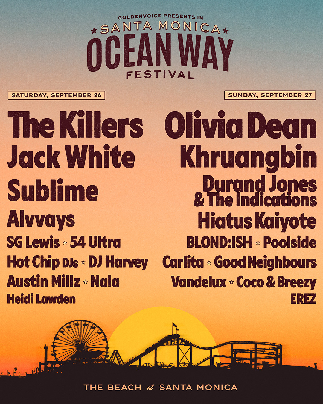
The World Cup brought thousands together throughout our downtown. This September, the Ocean Way Music Festival comes to our beach. On New Year’s Day, our float travels down Colorado Boulevard. Weeks later, ESPN broadcasts live from Santa Monica during Super Bowl week.
And in 2028, the Olympic and Paralympic Games will bring the world to our front yard.
For eight and a half square miles, this is an extraordinary opportunity.
But a city can host the world and leave its residents with nothing but road closures, traffic, and a cleanup bill.
We are determined to leave something more.
Every major event must produce a resident dividend: jobs, free public experiences, safer streets, better transit, and improvements that remain after the cameras are gone.
The events are not the prize.
The city we create because of them is the prize.
Our renaissance is what remains after the world leaves.
And we have another once-in-a-generation opportunity ahead of us.
At the end of 2028, the airport will close, and one hundred ninety-two acres will begin a new chapter.
This is a decision about what we want to leave behind.
Can we create a great public park where a child growing up in an apartment has room to run?
Can we create fields, trails, gathering spaces, and natural areas that bring neighborhoods together, restore habitat, and prepare for a changing climate?
We are not starting with a finished answer.
We are starting with a public promise.
This land will return to Santa Monica, and Santa Monicans are helping to shape what it becomes.
That is the future I want us to create.
A city that works.
A city where people belong.
A city that turns moments of enormous opportunity into something lasting.
And that brings me to the last thing I want to share tonight.
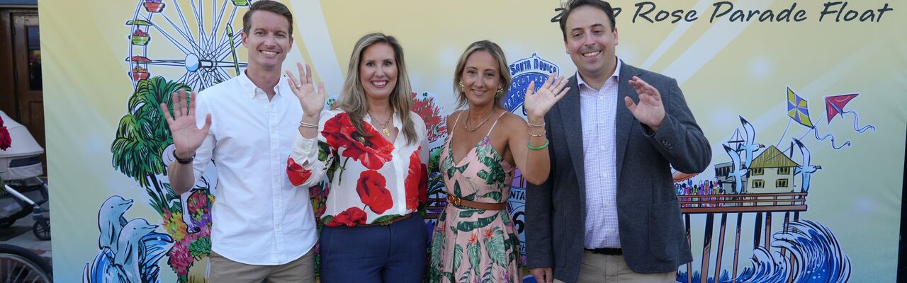
On New Year’s morning, for the first time in decades, a Santa Monica float will roll down Colorado Boulevard in the Tournament of Roses Parade.
Every visible inch of a Rose Parade float must be covered in something that was once alive: flowers, seeds, bark, leaves. Nothing artificial is permitted. The Rose Parade takes that rule very seriously.
It is attached by hand, one bloom at a time, in a cold warehouse in late December, by hundreds of people who mostly have never met.
So in December, we are going to run buses from Santa Monica to Pasadena.
I want you on one.
Not just to watch our float being created.
To help create it.
The theme of this year’s parade, which we did not choose but could not have chosen better, is one word: Welcome.
I have to tell you why that word stayed with me the way it did.
Every New Year’s Day of my childhood, my family watched the Rose Parade.
And every year, my mother told me the same story.
Growing up in Montreal, in the dead of a Canadian winter, she would turn on the television and see roses and sunshine.
In January.
She would sit there in the cold and imagine a life in California.
She was not from here.
That was the whole point.
She saw a place that looked like it would welcome her.
On New Year’s morning, my mom will watch that parade the way she has her entire life.
And this time, the float coming around the corner will be ours.
Welcome is not just a parade theme.
It is a governing principle.
A city that welcomes investment and imagination.
A city affordable enough for families to stay.
A city compassionate enough to welcome someone back after a difficult chapter.
A city confident enough to welcome the world without forgetting those already here.
It is the family facing an impossible rent increase that receives help to stay.
It is the business owner taking a chance on a storefront.
And it is a girl walking into the library across the street tomorrow, finding a librarian who knows her name and a book she did not know she was looking for, and understanding that there is no limit on what she is allowed to imagine.
That is the city we are choosing to be.
A city that works.
A city where people belong.
A city ready to welcome the future.
And now, it is time to see how Santa Monica will say welcome to the country with our Rose Parade float design.
This float will be uniquely ours because Santa Monicans helped create it, one living piece at a time.
And when it turns the corner on New Year’s morning, I want every Santa Monican watching to point at the screen and say:
I put that rose right there on the float
Because this city belongs to all of us.
Its recovery belongs to all of us.
And its future belongs to all of us.
Thank you, Santa Monica.


Social Buttons