

8:29 PM
-
0
Comments
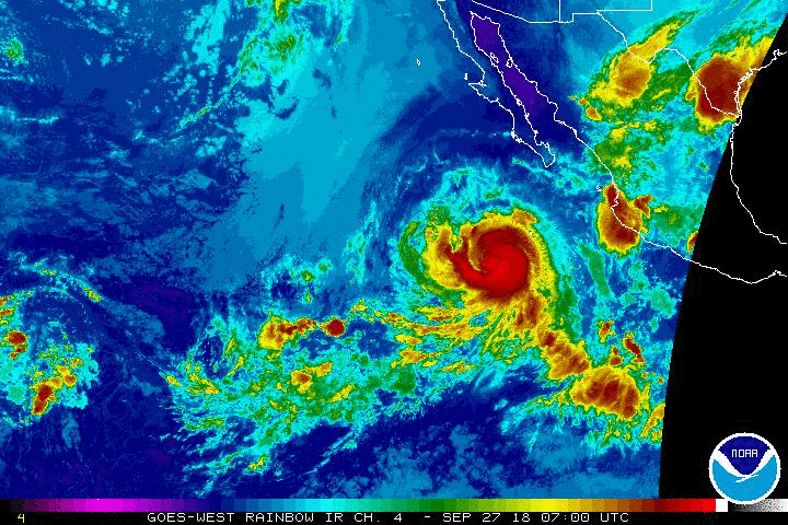 Rosa rapidly intensified into a Category 3 storm this evening with 110kt sustained winds and gusts to 135kt. Rosa is showing more of a defined eye in satellite imagery and expected to intensify more over the next 24hrs, before encountering cooler surface waters and increased wind shear.
Rosa is already within the SoCal and Baja swell window and will provide surf to these regions over the coming days. Rosa is around 570 miles southwest of the tip of Baja, heading west at nine knots. This motion is expected into Friday before a turn to the northwest then northeast occurs over the weekend. Rosa is forecast to make this turn while near peak strength, taking a more favorable northwest-northerly track for swell production. Overall, it’s likely that Rosa will take a good to eventually excellent track as a medium size, strong storm.
While Hurricane Rosa will deliver swell to SoCal and Baja, there are increasing concerns of a landfalling cyclone, plus the impacts of the storm's remnants. Rosa is expected to quickly weaken to a tropical storm before landfall first half of next week. Portions of Baja could begin feeling tropical storm force winds over the second half of weekend with a landfall in Northern Baja or Mexico around Tuesday. The system could then bring weather and rain to Southern California and the Southwest U.S.


No comments
Post a Comment