Latest News
Showing posts with label p fire. Show all posts


To our friends and neighbors from Pacific Palisades to Malibu to Altadena/Pasadena/Sierra Madre...

In the wake of the fires that changed our lives, we invite you to join us for a special evening at the Santa Monica Pier dedicated exclusively to the survivors.

This night is about us—a time for unity, joy, and celebrating the unbreakable spirit of our community, as we come together to heal and reconnect.

📍 Santa Monica Pier
Tuesday May 6, 2025
5pm-10pm
7:30-8:30 Esteemed Leaders & Hero's Awards
*This event is exclusively for fire victims. Please be mindful this private gathering is intended for neighbors to connect with one another.

This evening has one purpose: to reconnect.

🎤MC Jimmy Dunne

❤️ Handprint Unity Wall
A creative station where guests dip their hands in paint and leave their handprints on a large banner, creating a visual representation of their unity and commitment to rebuilding.

❤️Pali Strong Time Capsule
Each attendee brings a small personal item, note, or memento (e.g., a photo, a written wish, a token of remembrance) to be placed inside a sealed time capsule that will be permanently stored in the Palisades. This capsule will serve as a testament to the strength and unity of those who lived through this moment in history.

❤️Filiming Histories booth
Step into the Filming Histories Booth to share your personal experience of the Palisades fires. This is a space to record your story—whether it’s a moment of loss, resilience, or hope—for future generations to remember. Your voice becomes part of a collective archive, ensuring our community’s history is never forgotten.

❤️Tiles for future placement on DT Palisades wall
Leave your mark on the Palisades by contributing a personalized tile to be placed on the future downtown wall. Each tile tells a story—honoring resilience, remembering the past, and celebrating our community’s strength. Be part of this lasting tribute that will stand for generations to come. (Palisades residents only please)

Throughout the evening, there will be special booths and interactive spaces designed to stir your heart, honor our shared journey, and celebrate the strength of our community. From symbolic keepsakes to collaborative art and storytelling, each experience has been carefully curated to help us reconnect, reflect, and contribute to something lasting. Get ready for moments you’ll carry with you long after the night ends.

For more info and to register, Click Here

Find out about more upcoming local events, Click Here for the Event Calendar.


Topanga Canyon Boulevard (SR-27) remains closed to the general public for safety reasons between State Route 1 and Grand View Drive as extensive cleanup and repairs continue. Three crews have been working day and night in the emergency repair area.

While the closure remains in place, access has expanded to allow escorted school buses during designated times. Access is also permitted to law enforcement for public safety. Caltrans asks the public to heed the closure points and avoid the area for their safety as debris removal and repair work take place.

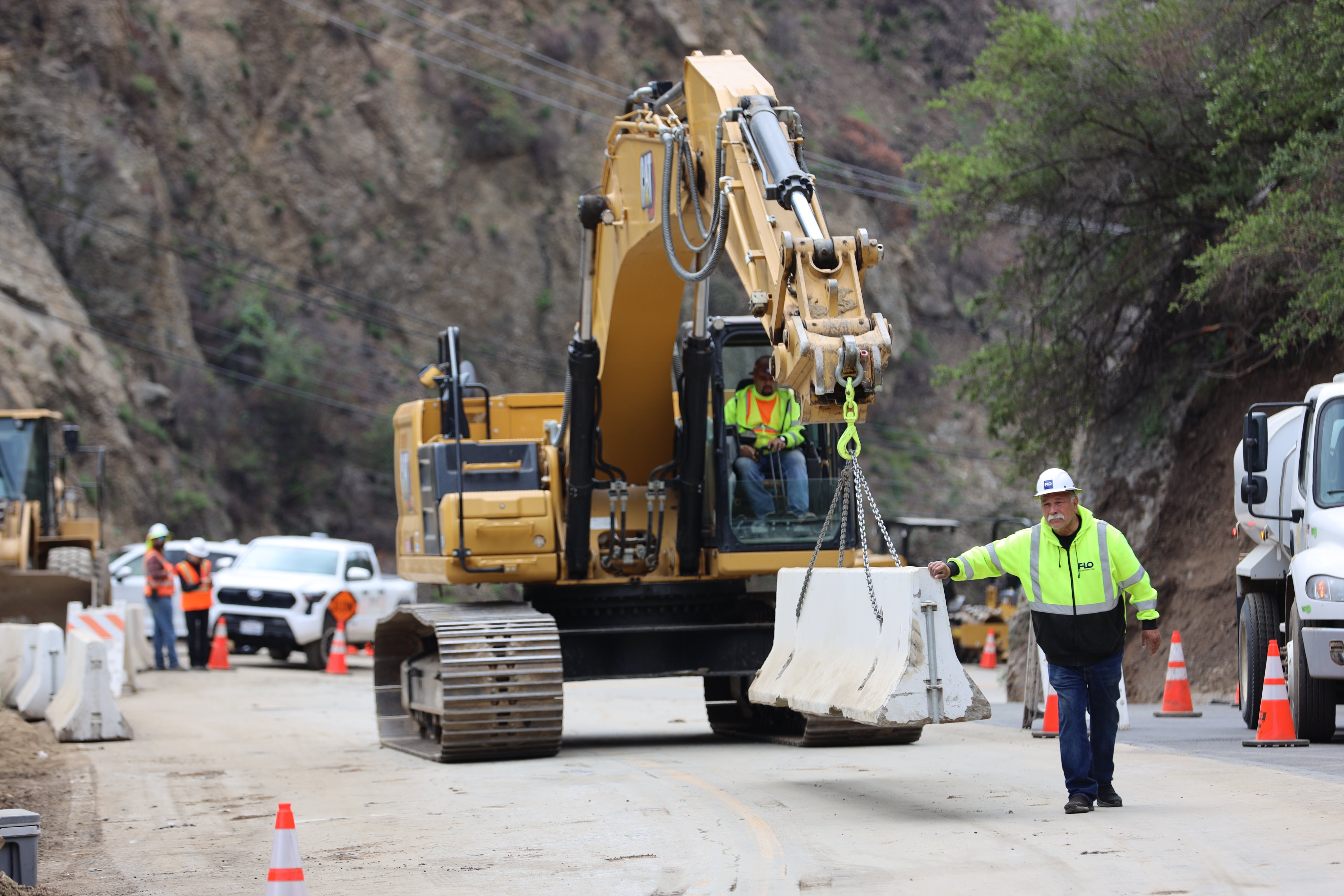
Caltrans and its partners continue to work on rebuilding and restoring the roadway by restoring retaining walls at three locations (postmiles 2.363, 2.52 and 2.712), the shoulder and a lane where the road was washed away. Caltrans is also installing debris flow barriers and larger culverts and clearing debris from nine locations where slides occurred. Through April, work will focus on a slide area near postmile 2.52 to install a new drainage system and culverts, as well as temporary paving to allow for one lane traffic through that location. Many of these improvements will help minimize the impacts of future debris/mudflows due to the extensive burn scars in the canyon.

Caltrans' contractor is making good progress on clearing storm debris. Debris removal from the February slides is nearing completion, with all 33,000 cubic yards of mud and debris cleared. To date, all dirt has tested clean. This material has been hauled out to farms in Somis and is also being used to replenish state park land impacted by the fire and storms. The storm that came in on April 26 brought down more debris, but that has been cleared.


The contractor is also conducting boring tests to determine how deep to drive the piles for the walls. Once they place K-rail and install the traffic signals for one-way traffic control, Caltrans can open the emergency repair section.

Extensive utility work continues with Southern California Edison undergrounding utility lines and the Los Angeles County Department of Public Works rerouting a water main connection that was exposed when the road washed away.

Caltrans and its partners aim to partially reopen Topanga Canyon Boulevard with one-way traffic control within two months.

For more news and updates on the Palisades Fire, Click Here.


Starting TOMORROW, Saturday, May 3, Caltrans contractors will begin installing temporary speed bumps at two checkpoints to enhance safety for the National Guard stationed there:

📍 Entrada/Chautauqua (Los Angeles side)

📍 Carbon Beach Terrace (Malibu side)

Installation begins around 6 AM on the Los Angeles side, then moves to the Malibu side once complete. One lane will remain open at all times for those with access passes into the burn area.

For more news and updates on the Palisades Fire, Click Here.


Tour of the clean up progress on the beach front properties along Pacific Coast Highway in Malibu Progress has been made on the clean up of several of the beach front homes along the Malibu coast near Big Rock. Most homes have been fully cleared of alltheir fire debris, while a couple have not. This was filmed right after the rain storm on Saturday afternoon, April 26th, 2025, exploring the area from the beach.

For more news and updates on the Palisades Fire, Click Here.


The U.S. Bureau of Alcohol, Tobacco, Firearms and Explosives (ATF) will be conducting controlled fire testing in the Santa Monica Mountains along Temescal Ridge Trail between Skull Rock and Green Peak.


The testing is set to occur during the evening of Tuesday, April 29 through Thursday, May 1. While this scientific testing will periodically include open flame in a small area that may be visible at a distance, it does not involve the burning of vegetation.

Los Angeles Fire Department personnel will be present before, during, and after all testing to ensure public safety and environmental protection. During this time period, there is no cause for public concern, or need to report the small testing flames that may be periodically visible near Tesmescal Ridge to 9-1-1.

Due to the remote terrain and logistics, there are no provisions for media or public access, and aircraft / drone pilots are instructed to follow any FAA issued restrictions for the area during this ATF testing.

For more news and updates on the Palisades Fire, Click Here.


Progress has been made on the clean up of several of the beach front homes along the Malibu coast near Big Rock. Most homes have been fully cleared of alltheir fire debris, while a couple have not. This was filmed right after the rain storm on Saturday afternoon, April 26th, 2025, exploring the area from the beach.

For more news and updates on the Palisades Fire, Click Here.


The Saturday morning rain brought down debris that's blocking both directions of Pacific Coast Highway at Topanga, Tuna and Big Rock, prompying a full hard closure between Topanga and Carbon Beach Terrace.


Crews are making good progress but still have to clear mud at Peña Road. PCH will remain closed tonight and will reopen Sunday at 6 a.m. to the same soft closure (residents w/burn scar passes, contractors, emergency responders and designated Metro, school buses.)

For more news, updates and traffic conditions on PCH and other local beachside roads, Click Here.


The beach and the bike path at Rogers State Beach in Pacific Palisades finally reopens after being closed to the public for over 3 months due to the Palisades Fire. The video above was shot on Friday evening, showing that the National Guard is gone and there is no more closure of the beach or bike path. The beach and bike path are open all the way to the end where Sunset Point is.

Pacific Coast Highway Closure remains enforced and the large Will Rogers Beach Parking lot is still closed. The Will Rogers Lot 1 (small lot at the Santa Monica border) is open.


For surfers wanting to go surf Will Rogers or Sunset, as of Friday evening, it is possible to go there via the bike path (and then walk the beach past the club to Sunset).

For more news and updates on the Palisades Fire, Click Here.


On April 22, Palisades Charter High School will begin holding in-person classes at the school’s new temporary location, dubbed “Pali South,” located at the site of the former Sears building at the corner of 4th Street and Colorado Avenue, 302 Colorado Ave.

Since the devastating wildfires destroyed much of the Pacific Palisades, including portions of the Pali High campus, Santa Monica teams have worked around the clock to assist schools, businesses and residents from impacted areas with their relocation efforts to Santa Monica.

Thanks to an emergency order approved by the City Council and dedication from city staff across all departments and cooperation and partnership from school leadership, the city has been able to help students at Pali High and other schools get back to in-person learning as quickly as is safely possible.

The school will hold classes at this new site through the end of the school year on June 6, then return to campus after summer break for the fall semester.

Pali South’s school day begins at 8:30 a.m. and lets out at 2:46 p.m.

Also nearby in the area, Santa Monica High School has a similar schedule.

Peak traffic is anticipated between 7-8:30 a.m. and 2:30-4 p.m. Those who don’t need to be in the area during these times are encouraged to avoid traveling there during these peak periods.

The first week of the new activation of this previously vacant corner will undoubtedly come with learning and adjusting. We appreciate the community’s patience as we observe and address traffic flow, drop off and other logistics at this new campus.

As we all prepare to welcome Pali High to downtown Santa Monica, below are some important details for students, parents, residents, businesses and their employees to prepare for the change in patterns downtown.

HOW WILL STUDENTS GET TO AND FROM SCHOOL?

Pali High’s student population comes from all over the region, comprised of families from nearly 100 different ZIP codes.

Students will arrive:

By public transit on the Metro E Line, Metro buses and Big Blue Bus
With their parents/guardians at the drop-off and pick-up lot located behind the downtown Metro E Line station, via the entrance on 5th Street
Via nine private charter buses sponsored by Pali High parents, with drop off inside the Pali South site
By car, with limited parking passes for students and school staff on school days for Parking Structures 5 and 6
Walking, biking, scooting from various locations

The city’s mobility team, in partnership with GoSaMo, the city’s Transit Management Organization, and Pali High leaders have been in close coordination to assist students and parents with transportation options.

Students, parents and anyone else traveling to the downtown area in the coming two months should give extra time for their commutes, think about avoiding peak times and explore non-driving options.

For personalized help with trip planning, GoSaMo offers online appointments. You can also reach them at (213) 425-0955 or Info@GoSaMoTMO.org.

Santa Monica has developed a traffic and mobility plan to make the transition as smooth as possible. This includes deploying changeable message boards, traffic safety personnel and adjusting signal timing for the best flow of traffic.

For the safety of all, please do not double park, stop at red curbs or stop at bus stops surrounding the school site.

Follow all traffic laws and avoid actions that may put your safety or the safety of others at risk. Use crosswalks and be aware of your surroundings as you make your way around the area.

PUBLIC TRANSIT

Public transit to downtown Santa Monica via the Metro E Line or Big Blue Bus is an easy, stress-free and affordable way to go.

These options are free for all students with a registered GoPass and offer a great way to access the new downtown campus. Students can contact their school’s administration for a free GoPass TAP card.

From the E Line Downtown Santa Monica Station, Pali High students can walk south into the drop off/pick up lot to access a pedestrian tunnel that will allow them to safely cross under 4th Street directly into the Pali South parking lot.

Discount rates and passes are available to city employees, income-qualified residents and many others. Find more information at metro.net.

Big Blue Bus and Metro are also free for all riders on Pali South’s opening day, in celebration of Earth Day.

Download the Transit app for iOS and Android to plan your trip via BBB and track your ride in real-time, or use Big Blue Bus’s online trip planner at bigbluebus.com/planner.

CHARTER BUSES AND LIMITED PARKING IN DOWNTOWN STRUCTURES

A limited number of parking passes are allocated to students and teachers on school days from April 22 through June 6 in Parking Structure 5, at 4th Street and Broadway, and Parking Structure 6, at 2nd Street between Broadway and Santa Monica Boulevard.

For those walking to campus from parking structures or otherwise, the front entrance of Pali South is the glass door along Colorado Avenue.

Private charter buses will bring many students to school from the region, as was also the case at the home campus. These buses will drop off students near the main entrance to the school site, entering and exiting through the driveway on Colorado Avenue.

CARPOOLING & DROP OFF/PICK UP

The drop off and pick up lot for Pali High will be the Metro drop off area located across 4th Street from the campus.

This lot is designed for brief stops and for active loading and unloading only. Cars waiting or parked in the lot will be asked to exit.

The best way to access lot is by exiting the I-10 West Santa Monica Freeway at 4th/5th Street in the right lane to turn onto 5th Street. Then merge to the left lane and turn left into the driveway of the parking lot.

Please note that there are no left turns from 5th Street onto Colorado Avenue when exiting the drop off lot.

From the drop off lot, students can access the pedestrian tunnel to safely cross 4th Street directly into the Pali South campus.

For a less congested drop off option, park at the metered parking on Main Street in front of City Hall and Tongva Park and have your student walk to school from there. And all city-owned Downtown Santa Monica parking structures are free for the first 90 minutes, so parents are also encouraged to explore pickup at those lots.

Drop off, parking or waiting are not permitted along 4th Street or Colorado Avenue.

Students can ride the Metro E Line a short distance from nearby stations at Expo/Bundy, 26th Street/Bergamot or 17th Street/SMC.

The Expo/Bundy Station is recommended for a faster pick up and drop off experience and to alleviate congestion in the downtown Santa Monica area. Take the Metro E Line three stops to and from the Downtown Santa Monica Station.

Metro will deploy additional ambassadors at the Expo/Bundy and Downtown Santa Monica Stations to help students with directions and provide assistance.

For commuters driving into downtown, exiting at the Lincoln Boulevard offramp may provide a smoother route. It may also be beneficial to adjust arrival and departure times, if possible, to avoid the morning and afternoon peak times.

Also of note: One lane in each direction will be closed on Lincoln Boulevard on April 21 and 22 between Broadway and Santa Monica Boulevard. This may cause impacts if exiting the freeway at Lincoln.

WHERE CAN STUDENTS EAT OR HANG OUT BEFORE/AFTER SCHOOL OR WAIT TO BE PICKED UP?

Santa Monica businesses are excited to welcome Pali High students! Go here for a list of local business specials and deals for students.

Access a list of all downtown businesses here. For list of places to eat at Santa Monica Pier, click here. And fun things to explore, click here. Any Santa Monica businesses who would like to submit a “Welcome to Santa Monica, Pali High!” special, can do so here.

Physical education classes during the day are set to be held at Historic Belmar Park and the city of Santa Monica has helped facilitate after school sports, meetings and other activities at various parks, libraries and city facilities around town.

Santa Monica’s Main Library is just a few blocks away from Pali South, at 601 Santa Monica Blvd., and offers many free resources and spaces for homework and studying ― open Monday through Thursday until 8 p.m. Find more at santamonica.gov/library.

We invite students and parents to spend a bit more time in Santa Monica to avoid the traffic and enjoy what the community has to offer.

The city hosts many free and low-cost arts, sustainability, and cultural activities and other classes and programming that all are welcome to attend. Visit the city’s website and events page for more!

WHAT ARE THE PLANS FOR SECURITY AT AND AROUND THE PALI SOUTH CAMPUS?

Santa Monica Police Department personnel are in close coordination with the Los Angeles County Sheriff’s Department, who oversees Metro public safety, to coordinate efforts at the E Line station. There will be an added security presence at E Line station and in the area around the campus/drop off lot.

Big Blue Bus's Transit Safety Officers are stationed on high-traffic routes and at select bus stops, to assist riders with navigating the system and addressing safety and maintenance concerns.

Downtown Santa Monica Ambassadors will also have an added presence around the Pali South campus, outside the E Line station and in downtown parking structures to assist with questions, security concerns and wayfinding.

The Pali South campus will be closed to the public. Students, teachers and school staff must show official school identification to get onto campus. Pali High will provide security personnel and campus aides to help answer questions and ensure everyone gets to school safely.

The pedestrian tunnel beneath 4th Street will only be open to students during arrival and dismissal. Students must stay on campus during school hours. Only seniors are permitted to go off-campus for lunch.

The Pali South campus will have 24/7 onsite security and will be closed outside overnight.

Santa Monica Police can be reached on the non-emergency line at (310) 458-8491.

For more news and updates on the Palisades Fire, Click Here.


Governor Gavin Newsom today announced an all-hands-on-deck effort to support businesses and tourism by expediting fire cleanup efforts so that State Route 1, the Pacific Coast Highway (PCH), will reopen to public travel by the end of May – well ahead of experts’ original predictions.

The Pacific Coast Highway is a major artery that serves hundreds of thousands of Angelenos and visitors from around the world daily and is crucial to connecting Los Angeles with Pacific Palisades, Malibu, and points north. Currently, PCH is only open to residents who live in the Palisades Fire burn area, essential businesses, and repair crews. Following the reopening, one lane in each direction would be available for public travel.

With the busy summer months along the coast fast approaching, the Governor’s Office of Emergency Services and Caltrans will effectuate the reopening by working closely with the United States Army Corps of Engineers (USACE) to prioritize the cleanup of parcels along PCH by surging additional crews into the area so that these parcels can be cleared of debris quickly.

Crews will work around the clock – literally 24/7 – to demolish the damaged and collapsed homes, remove toxic ash and soot, repair the roadways, and install new utility equipment.

There are currently more than 100 USACE crews (consisting of excavators, metal crushing equipment, and dump trucks) working on Palisades Fire parcels. All equipment and dump trucks utilize PCH as a path of travel for the haul routes. Currently, USACE is removing nearly 1,284 truckloads of debris per day.

Once their work is complete, PCH will be able to safely reopen to the public with one lane in each direction.

Once the highway is reopened, security checkpoints currently in place on the north and south ends of closure will be removed, but a robust law enforcement presence from state and local agencies will remain in place.

For more news and updates on the Palisades Fire, Click Here.


Public Health Releases Preliminary Soil Testing Results With Unanticipated Elevated Lead Levels in Parcels Downwind from Eaton Fire

The Los Angeles County Department of Public Health released preliminary findings from representative soil sample testing in and around the Eaton and Palisades fire areas, revealing a higher percentage of soil samples with lead levels above health-based screening thresholds from parcels with intact homes downwind of the Eaton Fire.

The preliminary findings also indicate localized chemical impacts to soil above health-based screening thresholds are present in the Palisades fire area, but there is no evidence of widespread contamination from fire-related chemicals.

The County’s soil sampling and analysis, conducted by Roux Inc., measured levels of harmful substances that may be present after a wildfire—such as heavy metals, polyaromatic hydrocarbons (PAHs), and dioxins—on representative soil samples from various parcels in different areas and with different property conditions in and around the Eaton and Palisades fire areas. Over four weeks from mid-February to mid-March, soil samples were collected from destroyed, damaged, and intact properties within the burn areas, as well as from properties just outside, and compared to current residential soil screening level thresholds. A final report and analysis will be available in May.

Levels below the screening thresholds are considered protective over a lifetime of exposure, even for the most vulnerable people. If levels exceed the screening thresholds, it does not automatically mean cleanup is required, but it suggests the need to consider additional evaluation.

Representative soil sampling involves collecting soil samples from different areas affected by the fire to assess contamination levels, such as ash or chemicals, and understand the overall impact on the environment.

The identification of high frequent lead exceedances in soil samples from downwind of the Eaton fire are consistent with reports of elevated lead in air samples collected in the days immediately following the fire. The source of lead in the fire is reasonably expected to be from the burning of homes with lead-based paint, which was common prior to 1979. CalTech reported that more than 90 percent of the houses in Altadena were built before 1975.

However, because there are many potential sources of lead in soil in the Los Angeles area, additional assessments will help understand how much of the lead found in the samples came from the 2025 wildfires versus other sources.

Testing identified isolated areas of heavy metal and PAH soil sample exceedances above screening thresholds in the Palisades fire area. The source is unknown at this time, but these are not consistent with communitywide impacts from fire-related smoke plumes.

This assessment provides a representative analysis of the soil in areas and under different conditions impacted by the fires. Individual parcels may have unique factors that result in differences compared to these representative samples. The reported results are not intended to imply cleanup or specific remediation is necessary; rather, the results identify areas potentially requiring additional evaluation.

Those with concerns about their specific property may want to test their soil and/or consult an environmental professional about evaluating their property. In all areas with on-going fire debris, residents are reminded to take precautions to not inhale, ingest or come into contact with ash, soot, and/or fire debris by using appropriate personal protective equipment. Additionally, community members are encouraged to review the soil sampling results and consider taking appropriate precautions if your home is in one of the areas where soil sample screening thresholds have been exceeded. Residents can refer to the Los Angeles County Department of Public Health’s FAQs for best practices to minimize exposure to these potential hazards.

In response to potential health risks from wildfire-related smoke, ash, and debris, the Los Angeles County Department of Public Health is offering free blood lead testing for individuals concerned about exposure to lead. Testing is available through three easy options: by visiting a medical provider (with costs covered by most insurance plans, including Medi-Cal), scheduling a free appointment at a Quest Lab by calling 1-800-LA-4-LEAD, or accessing walk-in mobile testing offered at select community events. Testing is fast, free, confidential, and does not require insurance. Lead exposure can be especially harmful to children and pregnant individuals, and early detection is key. For more information or to find testing locations, call 1-800-LA-4-LEAD (1-800-524-5323).

For larger versions of the following charts, Click Here


For more news and updates on the Palisades Fire, Click Here.


The Ocean Water Advisory due to Fire Impacts from Las Flores State Beach (SMB 1-14) to Santa Monica State Beach (DPH 104 A&B) has been lifted. Residents are still advised to avoid fire debris in the water, and to avoid being on beaches on or near burned properties.

After Rigorous Testing, Public Health Lifts Ocean Water Quality Advisory for Fire-Impacted Beaches - RESIDENTS CONTINUE TO BE ADVISED TO AVOID FIRE DEBRIS IN THE WATER, ON THE BEACH, AND ON OR NEAR BURNED PROPERTIES

The Los Angeles County Department of Public Health is lifting the Ocean Water Advisory due to Fire Impacts from Las Flores State Beach (SMB 1-14) to Santa Monica State Beach (DPH 104 A&B). This decision comes after the Los Angeles Regional Water Quality Control Board released results and analysis for testing on ocean water on January 22nd, January 27th, February 6th, February 18th , and March 13th, and sediment/beach sand testing from February 25th through February 27th.

The ocean water and sediment/beach sand testing, which looked for metals, nutrients, polychlorinated biphenyls (PCBs) and polycyclic aromatic hydrocarbons (PAHs), which are chemicals that may be found in water runoff based on previous California wildfires, revealed no chemicals related to wildfires at levels that are dangerous to human health

Beachgoers may now enter the ocean water and recreate on the sand in these areas, but they are still advised to avoid fire debris in the water, and to avoid being on beaches on or near burned properties, as the fire debris may contain harmful substances and physical hazards such as glass, metal, and sharp wooden debris.

High tides may carry fire debris into the ocean, creating hazardous conditions. In areas along the coast—particularly near burned or destroyed properties on the inland side of Pacific Coast Highway (PCH)—debris from recent fires has not yet been fully cleaned up. As the tides rise, this debris can be swept into the water, posing a danger to those in or near the ocean.

Residents are advised to continue following the Department of Public Health Ocean Water Advisories, which are non-fire related, and avoid entering the ocean water when ocean water quality exceeds State bacterial limits.


For more news and updates on the Palisades Fire, Click Here.


After almost 3 months, this video shows the current conditioins of the beach, creek, parking lot and general area around Topanga State Beach.

For more news and updates on the Palisades Fire, Click Here.


After almost 3 months, homes on the beach in Malibu are finally being fully cleared of all fire debris.

For more news and updates on the Palisades Fire, Click Here.


The City of Malibu, Supervisor Lindsey P. Horvath from LA County’s Third Supervisorial District, LA County’s Third Supervisorial District, LA County Sheriff’s Department, LA County Public Works, Caltrans and U.S. Army Corps of Engineers for an important discussion on the impacts of the Palisades Fire on Pacific Coast Highway (PCH), its progress and ongoing recovery efforts.

For more news and updates on the Palisades Fire, Click Here.


Touring the devastating damage from the Palisades Fire to all the homes on the hillside above the "Alphabet Streets" in the Pacific Palisades. These homes had beautiful views of the ocean, several are tagged as dangerous as they are in danger of falling onto the hilside.

For more news and updates on the Palisades Fire, Click Here.


UPDATE AS OF 3/25: Dukes Malibu is temporarily closed due to the mudslide that caused extensive damage. However, they are anticipate reopening this summer once they complete the cleanup and repairs. ds, Click Here.

For more news and updates on the Palisades Fire, Click Here.


Beachside Benefit at Perry's Cafe on the beach in Santa Monica. Zuma Cars & Coffee gather at this event honoring the great Malibu, Altadena and Pasadena Fire Fighters. This event directly benefits California Fire Foundation, Pasadena Humane Society, and Palisades Forever, three incredible organizations assisting fire-impacted communities through emergency aid, pet rescue and care, and essential supplies for families in crisis.

For more news and updates on the Palisades Fire, Click Here.


PACIFIC PALISADES A home on Castellammare Drive that survived the Palisades Fire was completely destroyed when the hill behind it came sliding down crushing it and covering the street.

For more news and updates on the Palisades Fire, Click Here.


Topanga Canyon Boulevard (SR-27) remains closed to the public for safety reasons between Pacific Coast Highway and Grand View as extensive cleanup and repairs continue. The closure is to protect the public from serious injuries and fatalities.

Caltrans is prepared to open the road as soon as it is safe to do so in coordination with the California Highway Patrol, utilities and local public agencies.

Caltrans expects to open one lane to school buses during designated times with an escort this week and is working on a plan with its partners to also allow essential business travel during this timeframe.


Progress has been made in cleanup efforts, with at least 8,600 cubic yards of mud and debris — equivalent to 860 truckloads — removed so far of the 33,000 cubic yards that came down on the highway after the February storm. All mud and debris are being pushed to the side of the road and tested. Clean dirt will be sent to Oxnard farms for reuse. To date, all dirt has tested clean.

Caltrans and its partners are working to restore Topanga Canyon Boulevard by building retaining walls in three locations and rebuilding the shoulder and lane where the road was washed away. Rebuilding the shoulder and lane will take at least a month, once a design is in place. Additionally, multiple locations throughout SR-27 will require the installation of debris flow barriers and installation of larger culverts. These improvements will help minimize the impacts of future debris/mudflows on SR-27 due to the extensive burn scars in the canyon..


For more news, updates and traffic conditions on PCH and other local beachside roads, Click Here.

For more news and updates on the Palisades Fire, Click Here.