
Latest forecast on
Hurricane Hilary:
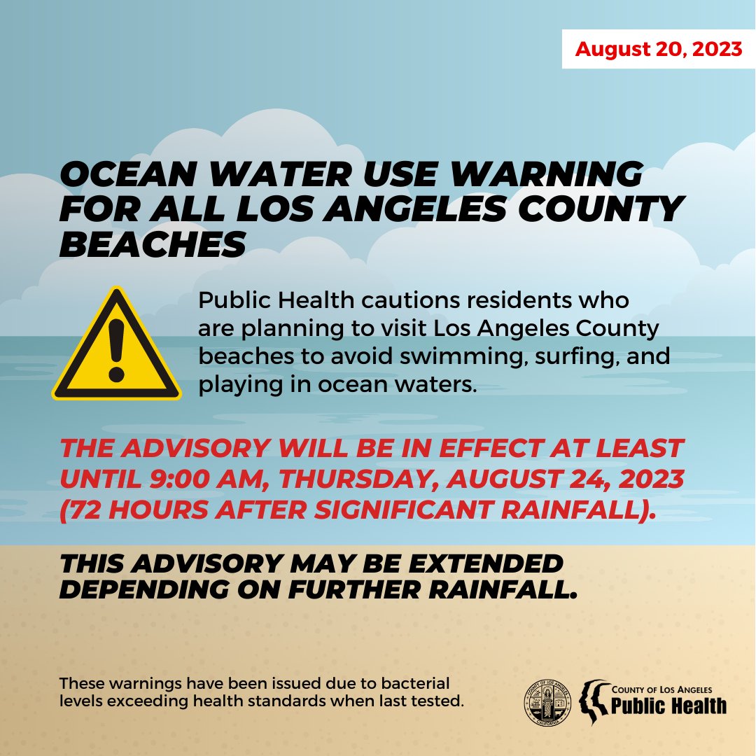
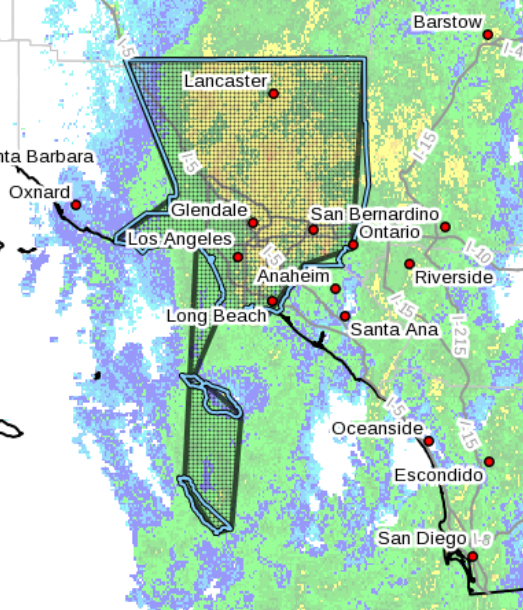
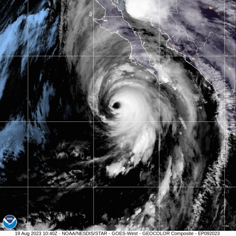
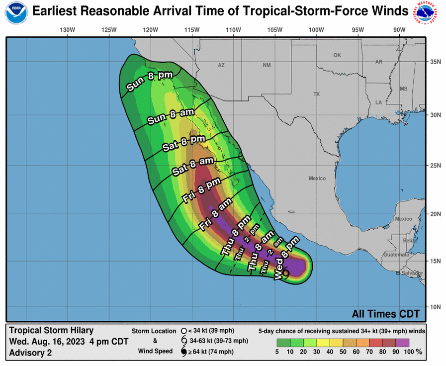
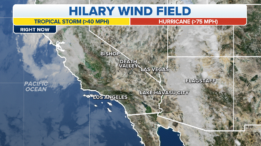
Currently a powerful CAT 4 storm. The Tropical Strom Watch has been expanded to include ALL of LOS ANGELES County, as well as mountains, valley and foothills of Ventura County.
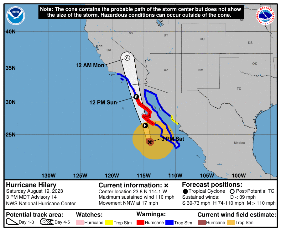
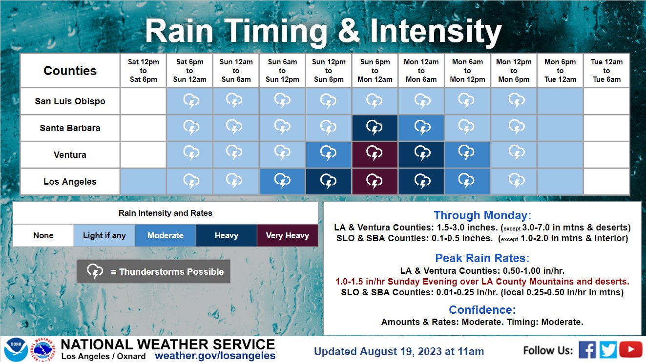
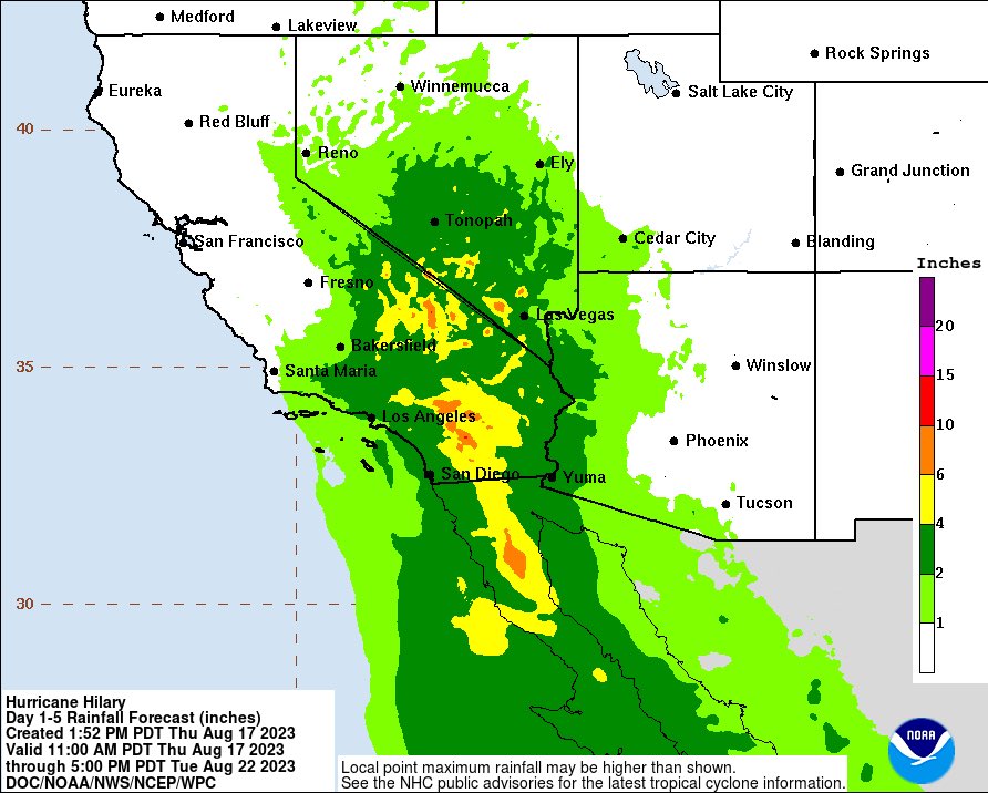
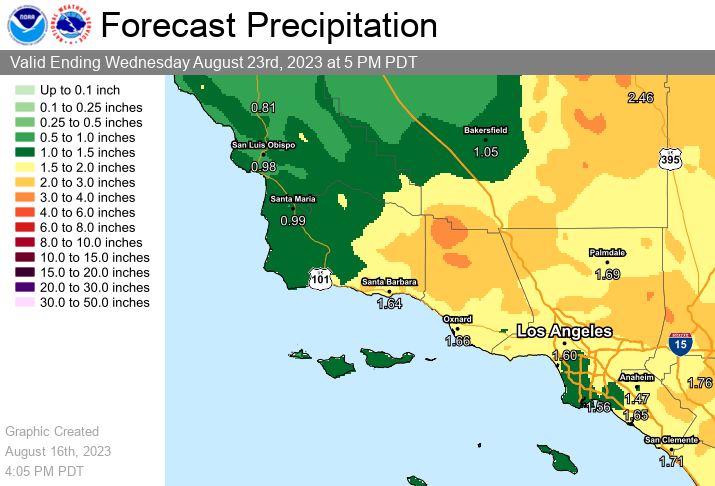
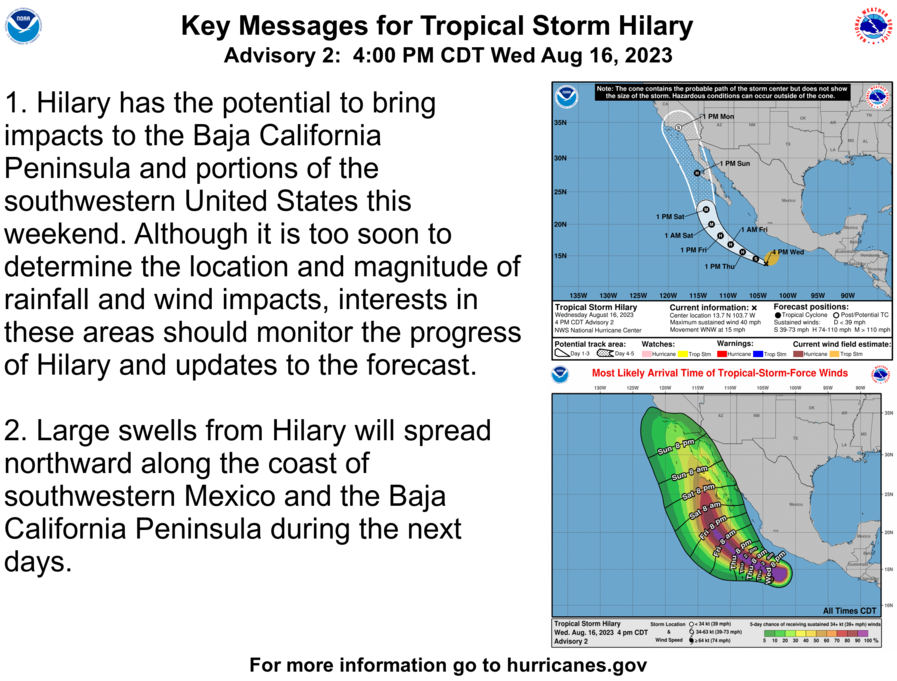
Hurricane Hilary will weaken to a tropical storm as it approaches Southern California this weekend. Flash flooding will be possible across the whole region, with rare and dangerous flooding possible across the mountains and deserts. Strong, tropical-storm-force winds will be possible Sunday through Monday, strongest over the mountains, valleys, and foothills of Los Angeles and Ventura Counties.

As
Hilary develops, there will be increasing southeast swell across the coastal waters Sunday through Tuesday.
High surf (4-7 ft if not a bit higher) is possible on South-East and South facing beaches. Also, strong rip currents will be likely.
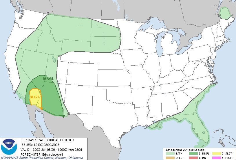
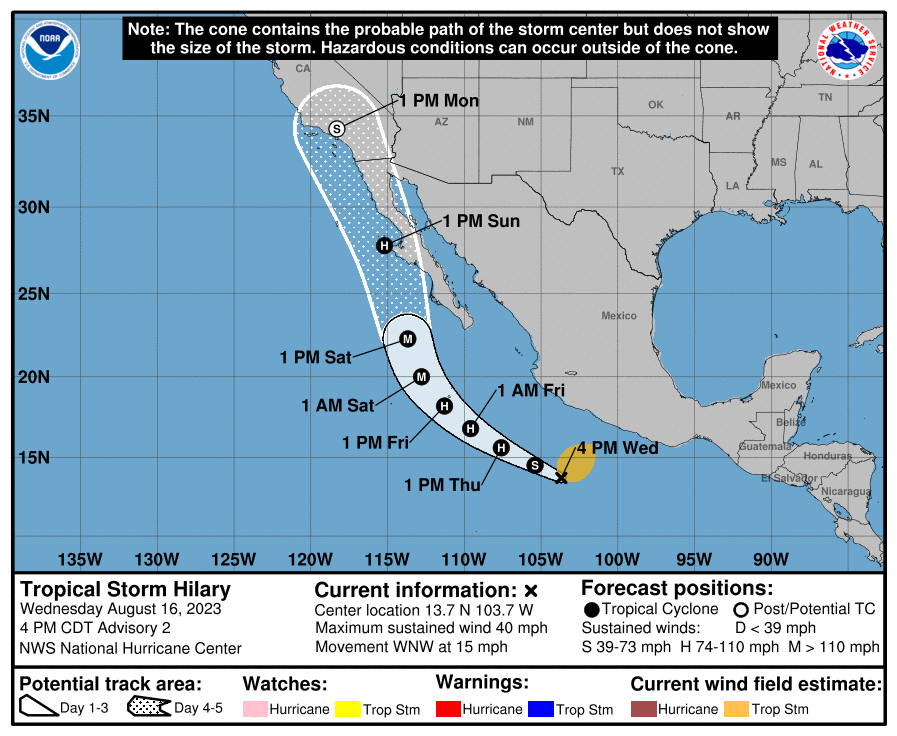
Heavy rainfall is expected to impact the Southwestern U.S. starting Friday through early next week, "peaking on Sunday and Monday," according to the hurricane center. The last tropical storm to impact the state was 84 years ago, according to official records.
As expected,
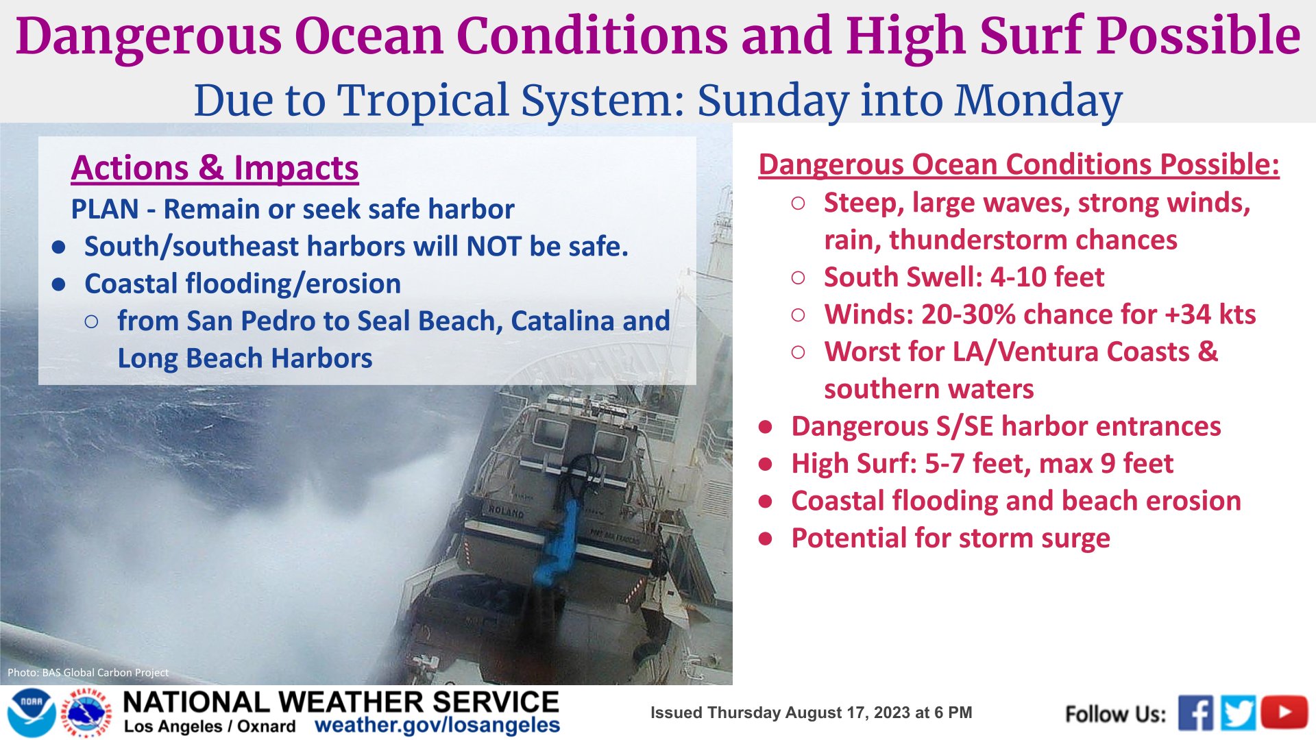
Hurricane Hilary will bring the potential for significant marine issues Sunday-Monday:
- High surf
- Strong winds
- Dangerous rip currents
- Coastal flooding/beach erosion
- Dangerous conditions for S and SE facing harbors
There is a tiny window for swell production based on the storms current location and forecast. That being said this will be a steep angle swell (154°-160) with impacts mostly to South & South South East facing exposures. In Los Angeles County these locations include Cabrillo Beach, South facing exposures along the Palos Verdes Peninsula, East facing harbors on Catalina Island (Avalon & Isthmus), as well as Malibu & Zuma Beach in the Northern half of the Santa Monica Bay. While these locations will likely see the largest potential for swell, be prepared to see elevated surf heights at all Los Angeles County Beaches beginning Sunday and into early next week.
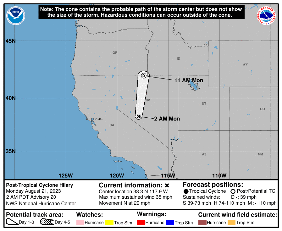
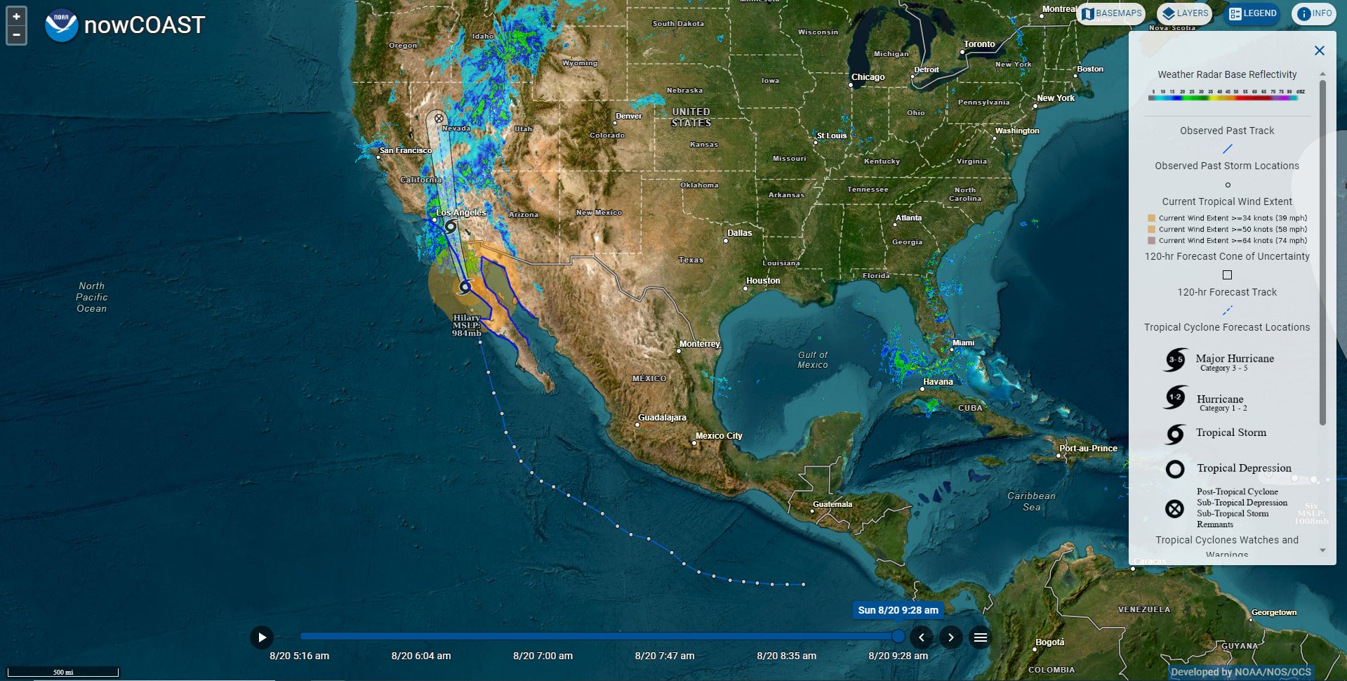
Powerful Hurricane Hilary, which was located about 1100 nautical miles south southeast of San Diego at 2 AM this Friday morning, will move northwestward today, turn toward the north-northwest while beginning to gradually weaken Saturday through Sunday. The latest official forceast has this storm tracking just to the east of San Diego Sunday night or early Monday morning as a tropical storm, then weakening quickly to a post-tropical remnant low as it moves across the deserts of southern California.
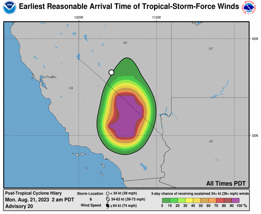
Computer models indicate a 20 to 30 percent chance of tropical storm force sustained east to south winds of 34 knots or higher across portions of the coastal waters Sunday night into Monday. This will be most likely across southern portions of the coastal waters. If these winds develop, they will be accompanied by large steep seas of 5 to 9 feet from the south through east. South through east facing harbors could experience extremely hazardous conditions during this time.
Large waves could cause flooding of low lying areas and parking lots, as well significant beach erosion. Residents who live in areas susceptible to coastal flooding should take steps now to prepare for this possibility.
Thunderstorms with heavy rain and locally stronger winds could also occur with this storm.
Patchy dense fog will continue to affect portions of the coastal waters this morning, with visibilities of 1 NM or less at times.
For more news on this,
Click Here


Social Buttons