

3:39 PM
-
0
Comments
Tropical Storm Hilary strengthened into a hurricane Thursday, with forecasters warning it could potentially bring devastating rainfall and high winds to Southern California this weekend.
As Hilary develops, there will be increasing southeast swell across the coastal waters Sunday through Tuesday.
High surf (4-7 ft if not a bit higher) is possible on South-East and South facing beaches. Also, strong rip currents will be likely.
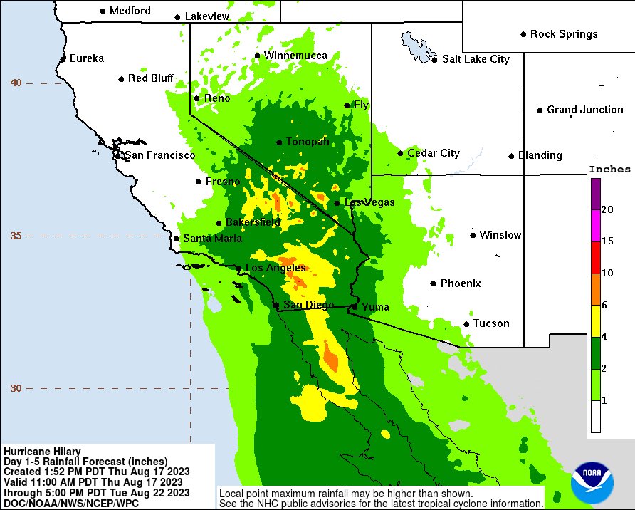
Heavy rainfall is expected to impact the Southwestern U.S. starting Friday through early next week, "peaking on Sunday and Monday," according to the hurricane center. The last tropical storm to impact the state was 84 years ago, according to official records.
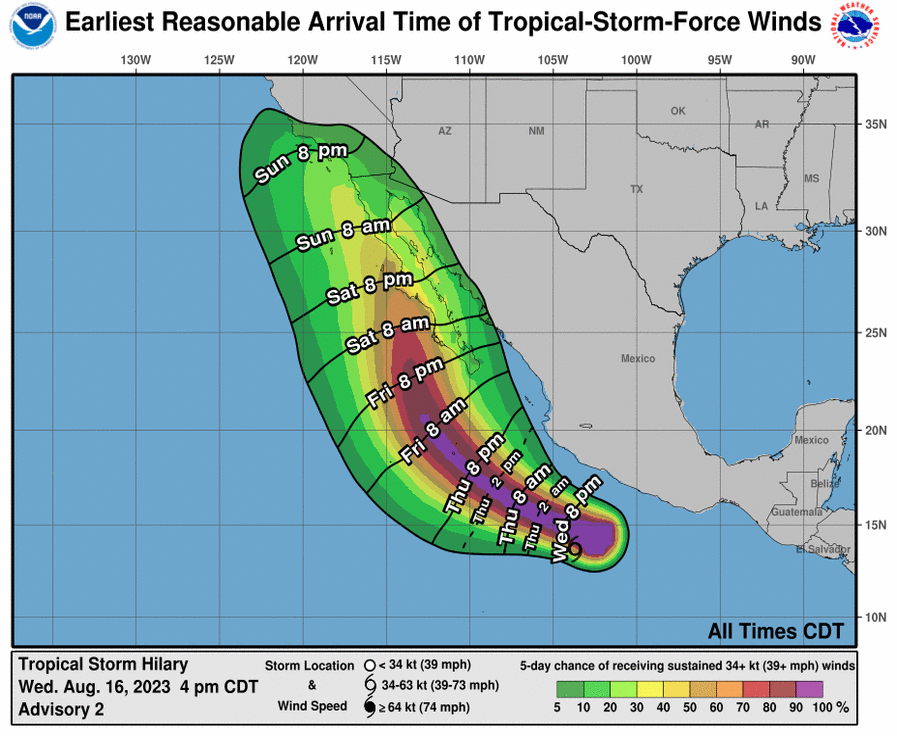
Hurricane Hilary was located about 475 miles south of Cabo San Lucas, Mexico, Thursday afternoon, with maximum sustained winds of 110 mph, the upper limit of a Category 2 storm. It was moving west-northwest at 14 mph. The storm is expected to continue moving in a west-northwest direction, the center said, with a turn toward the northwest expected Friday morning.


Some spots in the desert Southwest could pick up a year's worth of rainfall in just two to three days.
Large swells generated by Tropical Storm Hillary will affect portions of the coast of southwestern Mexico and the Baja California Peninsula over the next few days. Those swells, according to the NHC, are likely to cause life-threatening surf and rip currents.
For more news on this, Click Here


No comments
Post a Comment