Latest News

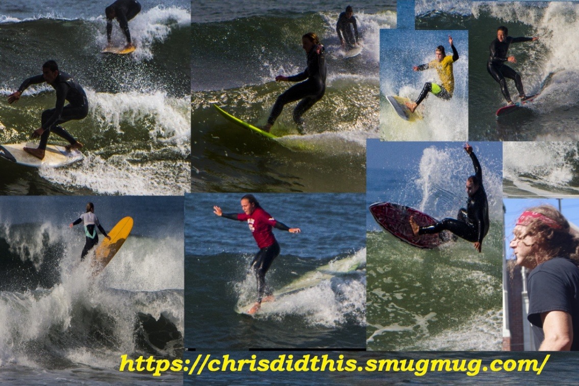
According to Surfline: NW and SSW swell mix tops out Sat, slowly eases Sun into Mon.

Saturday, March 6th: 4-5′ surf good spots, 6’+ focal points off peaking combo of swells. Variable AM wind.
Mid to longer-period NW swell mix tops out along with off-season SSW Southern Hemi swell. Most of the region tops out around waist-chest-head high with good winter/combo magnets occasionally overhead. Morning wind is light/variable for most areas. Afternoon sea breeze is running 6-10kts along much of the coast, with more moderate+ onshores expected from northern LA through Ventura.

Sunday, March 7th: 3-4′ waves off easing swell mix, best breaks 5’+. Variable to onshore AM wind.
The blend of NW swell and longer-period SSW Southern Hemi will be tapering off. Most size shows in the morning, with good spots running waist-chest high+. Surf size will gradually wind down during the day as the swell combo subsides. Morning winds look mixed at this point. Northern LA is expected to have more moderate SE to E winds. Light+ to moderate westerly flow due from LA northward in the afternoon.

Here's some surf photos from March 4th at County Line. These were taken from around 3:30PM till about 4:20PM. This set was shot by ChrisDidThis.

These are just a few of the photos from this session. If you were out there, you probably got some surfing shots, probably multiple photos, they will be in the complete photo gallery for this day, check them out, the link to the gallery is down below.


You can find more photos from this session, all full size and in high-resolution, in this photo gallery:

County Line - Thursday 3-4-2021 Photo Gallery


If you were out there, we probably got some cool surfing shots of you, go check them out!

Wanna see photos from previous days at this and other local surf spots?
Click Surf Spot Galleries and look for the spot and then the date.


Here's some surf photos from Thursday, March 4th at Zeros.

This set was shot from about 4:30PM till 5:40PM by ChrisDidThis.

These are just a few of the photos from this session. If you were out there, you probably got some surfing shots, probably multiple photos, they will be in the complete photo gallery for this day, check them out, the link to the gallery is down below.


You can find more photos from this session, all full size and in high-resolution, in this photo gallery:

Zeros - Thursday 3-4-2021 Photo Gallery


If you were out there, we probably got some cool surfing shots of you, go check them out!

Wanna see photos from previous days at this and other local surf spots?
Click Surf Spot Galleries and look for the spot and then the date.


California's Tsunami Preparedness Week will be March 22 - 26 in 2021! Learn how you can register to participate in a variety of activities to help you, your family, school, or workplace get better prepared to survive and recover from tsunamis

Visit www.tsunamizone.org for more info.

Info from the armed robbery at Venice and Dell on Monday night:


Here's some photos from FightBackVenice that show there was another fire at another homeless encampment on the Venice Boardwalk.


On Sunday morning there was a 4 acre brush fire at 3477 Malibu Canyon Rd, Malibu. The fire shut down PCH, but was quickly put out and the the road closures have been lifted. PCH is now open. Las Virgenes Rd/Malibu Canyon Rd remain closed from Mulholland - PCH.

Photos from Lost Hills Sheriff Station.


According to Surfline: Old combo of NW and SSW swells drops going into the weekend, as a fresh, shorter period NW swell takes over.

Saturday, February 27th: 2-3’+ waves off peaking NW swell, 4’+ for top spots. Light winds in the morning.
A reinforcing pulse of shorter period NW swell tops out, putting well exposed spots in waist-stomach high surf. Deep mid morning high tide (~6′) favors shorebreak sandbars, while most other spots are swampy then. Mid day tide works best for many areas, before the ocean ebbs down to a drained, -1′ mid afternoon low. Light/variable to light offshore winds much of the morning, shift to light+/locally moderate afternoon onshores for textured+ to ruffled conditions. The sea breeze looks to ease by the evening.

Sunday, February 28th: 2-3′ surf from fading NW swell. Moderate to breezy morning offshores.
The shorter-period NW swell will be steadily winding down. Morning sees the most size. Surf gets smaller as the day goes on. Widespread ENE winds in the morning, moderate for most areas and looking stiff around northern LA, for offshore conditions. Those winds due to ease into mid day, then turn to onshores along most of the coast during the afternoon. Deep mid morning high tide swamps out lots of spots, while favoring shorebreak sandbars. Negative low tide in the later afternoon drains the smaller waves.
Here are the projected peak wind gusts from late Saturday night into Sunday morning for the Los Angeles area due to the gusty Santa Ana winds.