

7:38 PM
-
0
Comments
Hurricane Norman Weakens to Cat 3, Modest Swell Reaches SoCalNorman has weakened a notch through the day, dropping to 110kts, losing some of its visually impressive structure along the way. The cyclone is now asymmetrical with a closed eyewall as shear impacts the northeastern part of the storm. A gradual but steady decrease in intensity is forecast through the period. Norman poses no threat to land at this time, tracking westward away from the mainland. Remember that Norman is a small cyclone, well over a 1000 miles from SoCal and moving in the wrong direction -- all strikes against swell reaching back into SoCal.
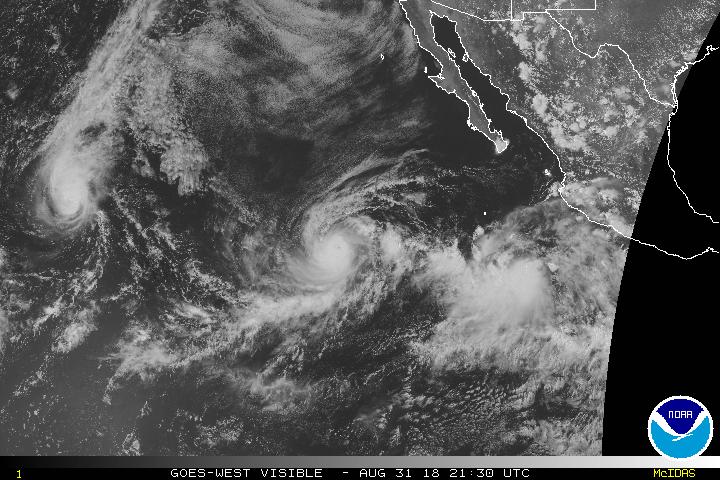
Latest visible satellite image of the Eastern Pacific shows Hurricane Norman in the center, Hurricane Miriam off to the west, and a low pressure system to the east of Norman that is forecast to become Olivia next week.
Latest Storm Info
Norman is now a top-end Cat 3 Hurricane with 110kt sustained winds in Friday's 2pm PDT advisory. Norman is over 750nm west-southwest of Cabo San Lucas, heading west-southwest at seven knots and is no threat to land at this time. Norman continues a gradual weakening trend as shear impacts the cyclone and it moves over cooler surface waters.
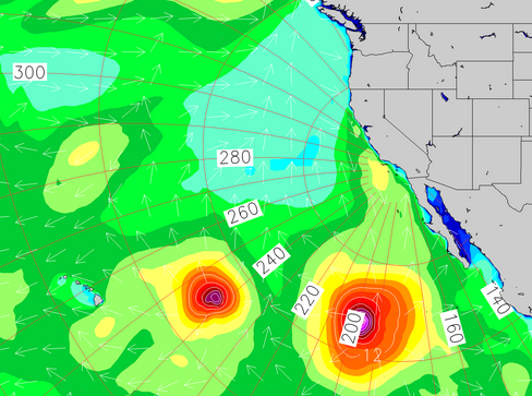
Norman is expected to remain a hurricane through the official five-day forecast period, potentially losing that status around the end of the forecast period. Expected track continues to the west-southwest before turning back west-northwest over the weekend.


No comments
Post a Comment