12:14 AM
-
0
Comments

Elevated surf and strong rip currents are expected to continue throughout Tuesday, July 11 and Wednesday, July 12, due to a southerly swell stemming from Tropical Storm Eugene, according to an alert from the National Weather Service (NWS) on Tuesday.
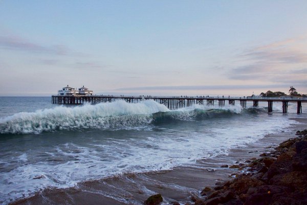
The tropical storm, formerly a hurricane, is churning in the Pacific Ocean off the coast of Baja California. NWS forecasters estimate surf heights between 5 and 8 feet through Wednesday evening, with the highest along south-facing beaches in Los Angeles and Ventura Counties, including Malibu, Zuma, Long Beach to Palos Verdes Peninsula, Point Mugu, and beaches on Santa Catalina Island, according to the NWS statement.
Dangerous rip currents and unanticipated large coastal waves, known as sneaker waves, are expected to accompany the high surf. Rip currents, which are strong currents of water flowing away from the shore with surf, are predicted to be frequent.
“There is an increased risk for ocean drowning, especially with more people seeking relief from the hot inland temperatures. Rip currents can pull swimmers and surfers out to sea. Large breaking waves can wash people off beaches and rocks and capsize small boats near shore,” the NWS alert stated.
A high surf advisory will be in effect until 10 p.m. on Wednesday. Forecasters advise beachgoers to swim near lifeguard stations. If caught in a rip current, swimmers are advised to relax, float, and remain parallel to shore until they are able to break free. If unable to escape, swimmers should face the shore and wave or call for help.
According to AccuWeather, Eugene is considered the strongest tropical storm in the Eastern Pacific so far this season. As the storm weakens, the waves and rip currents will likely decrease in strength later this week.


No comments
Post a Comment